
In terms of which trail is “the best day hike in Yosemite National Park”, Half Dome may get all the press, but I’d argue the best day hike in Yosemite is easily the Panorama Point Loop Trail.
It is quite simply, as others* have noted, “the ultimate Yosemite day hike”.
Hiking The Panorama Loop Trail [Via The JMT] (Yosemite National Park, CA)
Editor’s Note: This article is part of my ongoing series on California
Click here for more on Yosemite National Park, and here for more on Things To Do In The State of California
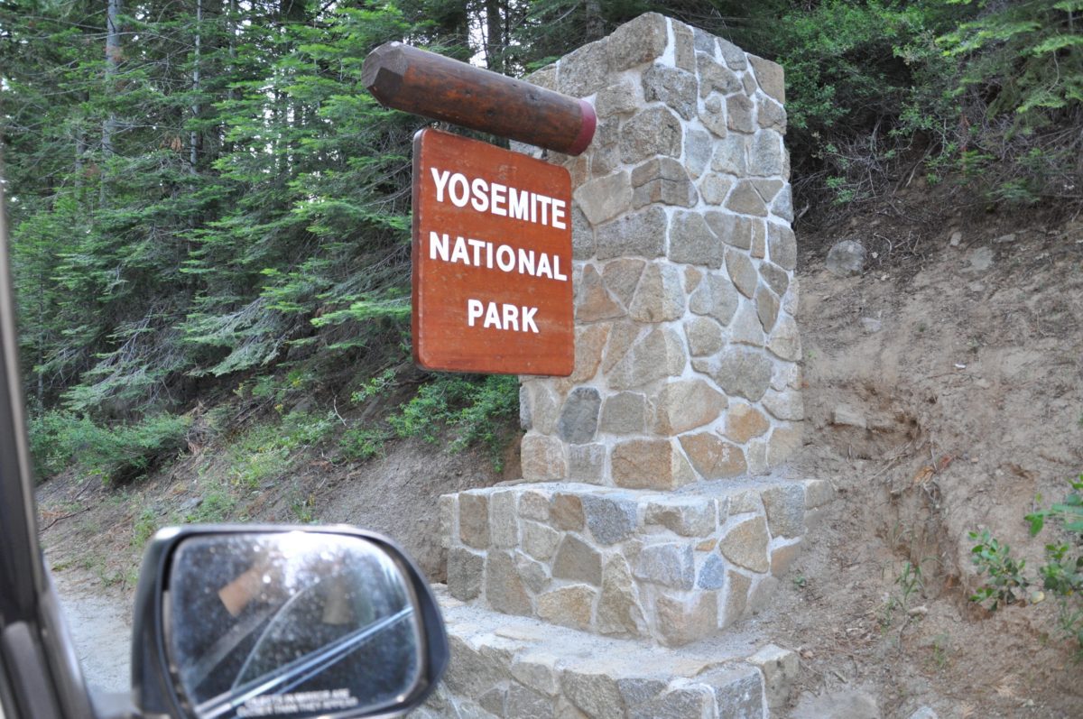
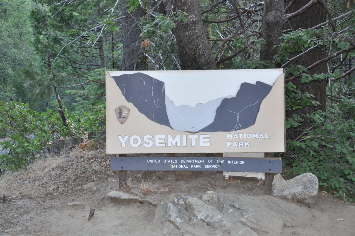
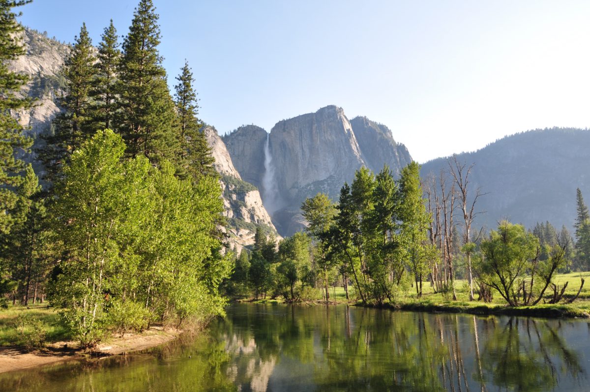
Welcome to Yosemite National Park!
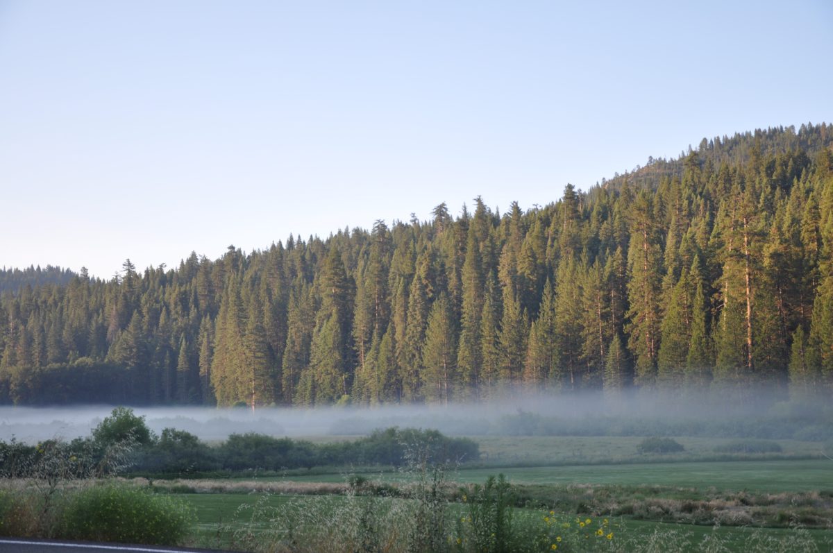
A morning fog hangs over the Wawona Hotel’s golf course.
About The Panorama Loop Trail (Via The JMT)
The Panorama Point Loop Trail is my favorite day hike because it combines sections of four incredible trails (the Mist Trail, the John Muir Trail [JMT], the Panorama Trail, and the Four Mile Trail) into one comprehensive 15-mile[ish] loop trail.
Starting in Yosemite Valley, this heavily-trafficked trail climbs steadily upward 2000 feet to Nevada Fall, then meets up with the Panorama trail for the trek to Glacier Point, before following the Four Mile Trail for the return trip down to the valley floor.
FHOP Tip: As with most trails in Yosemite, this hike can be done several ways by using different starting points, directions, and trails. I prefer parking and starting in Yosemite Valley and hiking up to Glacier Point in a clock-wise direction. This allows me to spend the morning in Little Yosemite Valley, eat lunch atop Nevada Fall mid-day, hit Glacier Point in the late afternoon, and to hike back down to the Valley before dark.
Along the way, hikers are rewarded with incredible and seldom-seen views of apex-Yosemite landmarks such as Nevada Fall, Half-Dome, Liberty Cap, Glacier Point, Yosemite Falls and Yosemite valley.
For the adrenaline junkies, this trail provides access to views of Panorama Point and Illilouette Fall.
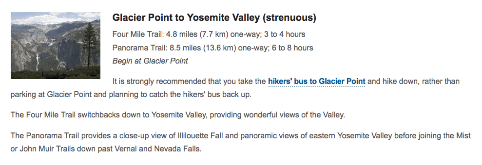
The National Park Service lists this trail in two parts, Yosemite Valley to Glacier Point (via the Panorama Trail) at 8.5 miles, and the return from Glacier Point to Yosemite Valley at 4.8 miles. This mileage does not include the approximately .5 mile roundtrip “side-trip” to Nevada Fall, nor the extra mileage by taking the JMT vs. the Mist Trail, nor the mileage needed to get to your car from either starting or ending trailhead.
FHOP Tip: A great variation to this loop trail is to take the Mist Trail instead of the JMT to Nevada fall. The JMT is slightly longer, but it ascends through a series of gentle switchbacks and smooth straight-aways to Nevada Fall, whereas the Mist Trail is shorter, but far steeper and more challenging, and consists mostly of stairs for the duration of the way up to Nevada Fall. However, the Mist Trail has something the JMT doesn’t, an up-close view of Vernal Falls. Personally, I think everybody should do both variation of this hike at least once in their lifetimes!
Due to the mileage and elevation gain of this trail, I classify this trail as “strenuous” but totally “doable”. It is an “all-day hike,” thus you should plan on starting as early as possible and meeting mileage goals accordingly so as to finish with enough daylight to return to your vehicle or lodging. Plan on bringing hiking poles, sun protection, and enough water. There are abundant water sources along the trail if you have a personal water filtration system.
Although there are no sections of trail putting you in immediate “mortal danger” (like the ropes at Half Dome), there are vertigo-inducing legs and plenty of opportunities to get seriously hurt (or worse) if you do not exercise good judgement and pay attention to the trail by watching out for slick rocks, sheer drop-offs, time, and fast-moving water.
FHOP Tip: If you choose to start at Glacier Point, I recommend taking the JMT or the Four Mile Trail down to the Valley floor (vs. the Mist Trail), as the Mist Trail has many more stairs and is much harder on the knees going down. Because the Mist Trail also runs near Vernal Falls, it may also be much more wet and slick. For these reasons, I wouldn’t recommend hiking down the Mist Trail.
The Official Trail Description From The National Park Service
The Map: The Panorama Loop Trail (Via The JMT)
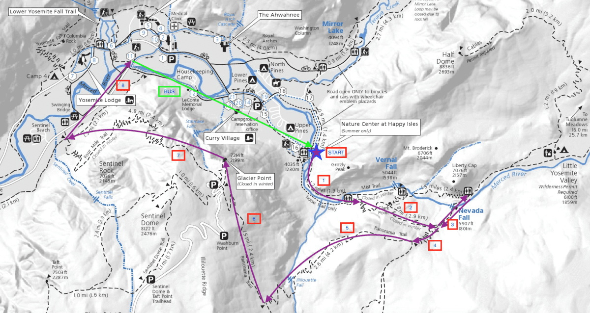
The “green line” represents the Valley Shuttle route, the “purple star” the trailhead, and the “purple arrows” the direction of the trail segments.
Getting To The Trailhead
Logistically, this hike can seem a little daunting. But it doesn’t have to be.
I recommend parking near the trailhead of the Four Mile Trail by Swinging Bridge, and then walking over to the Yosemite Valley Shuttle stop at Camp 4 (#7) or Yosemite Lodge (#8).
From there, you can take the Valley Shuttle to the Mist Trail trailhead at the Happy Isles stop (#16).
View of Yosemite Fall from Swinging Bridge (on the way to the shuttle stop (#8) at Yosemite Valley Lodge)
The Trailhead
From the shuttle stop at Happy Isles (#16), simply follow the crowd over to the trailhead (below).
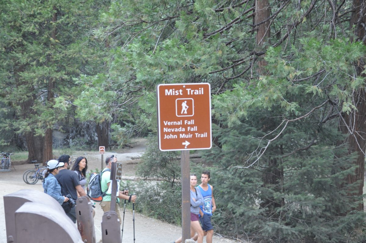
The official trailhead sign
Section 1: The Mist Trail To The JMT (1 Mile)
From the trailhead, the trail will start off seemingly slow and relatively flat.
However, most people find themselves winded on this section as the trail rapidly gains in elevation while mesmerizing hikers with its views.
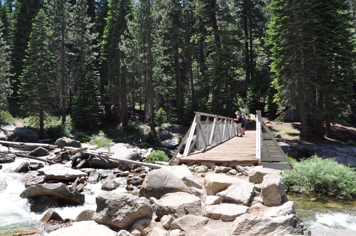
In no time, the trail reaches the footbridge where Vernal Fall becomes visible.
Just beyond the bridge, the trail meets a fork at the junction of the JMT and the Mist Trail.
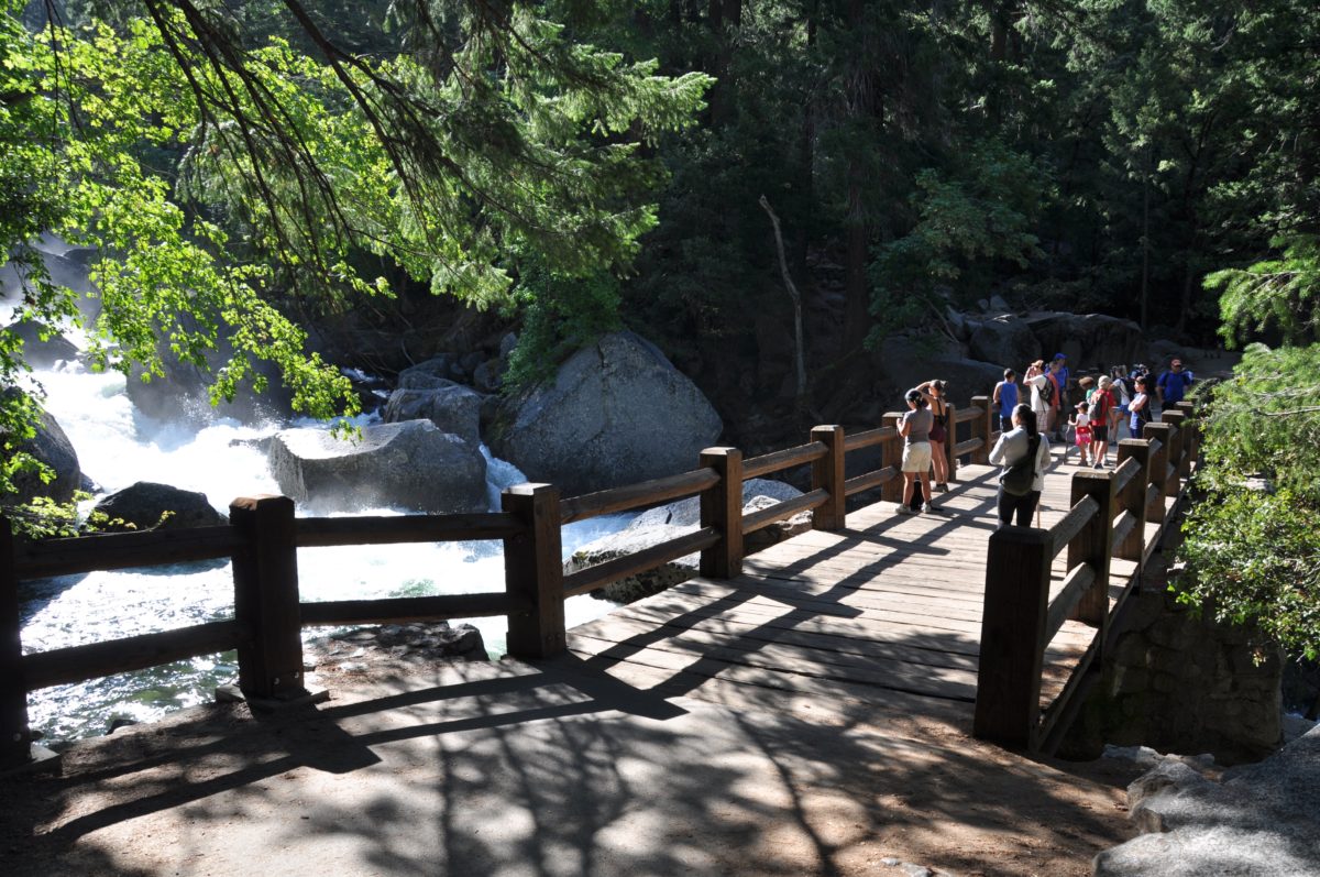
The Vernal Fall Footbridge
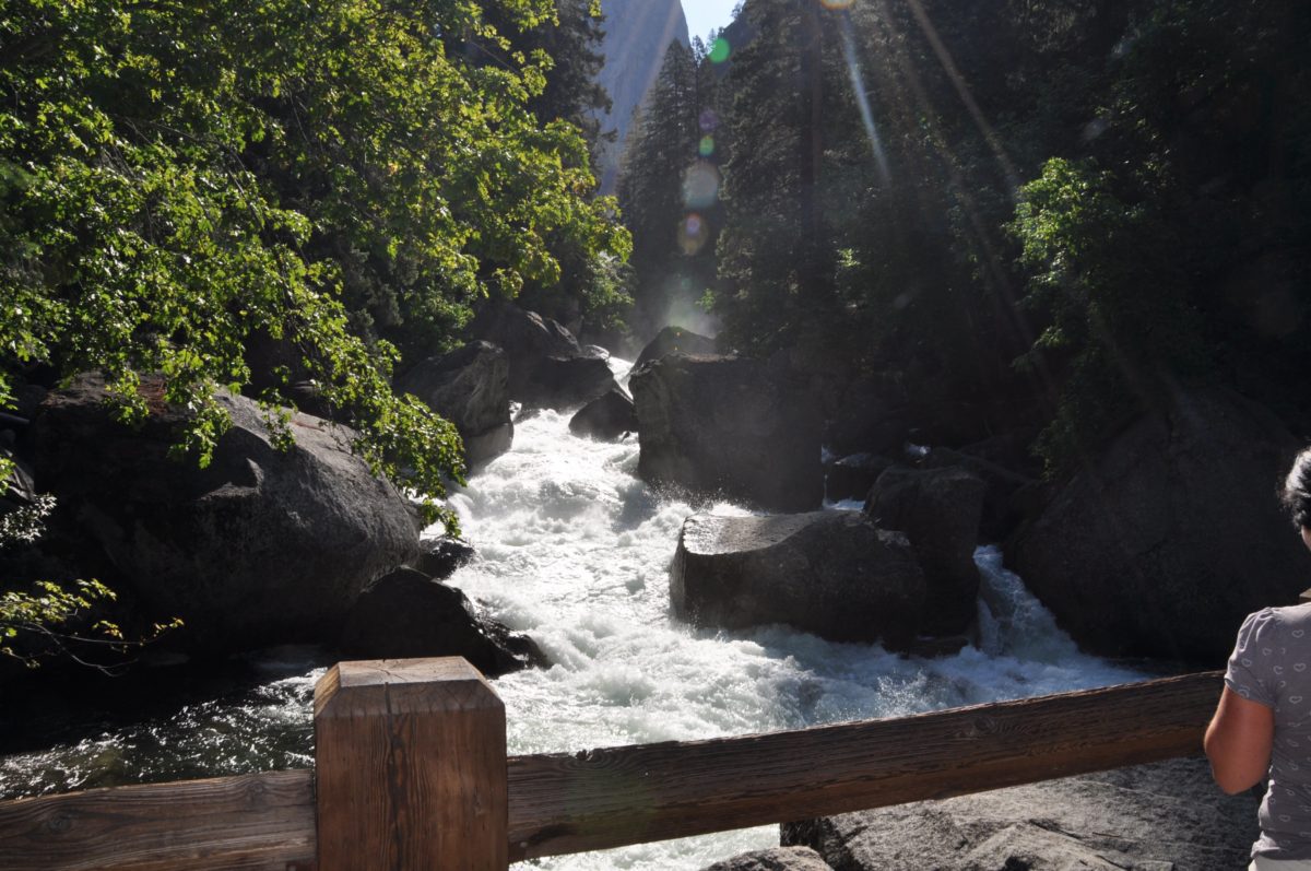
Vernal Fall peeks out through the trees upstream
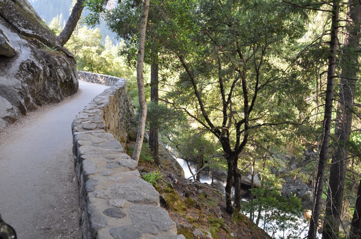
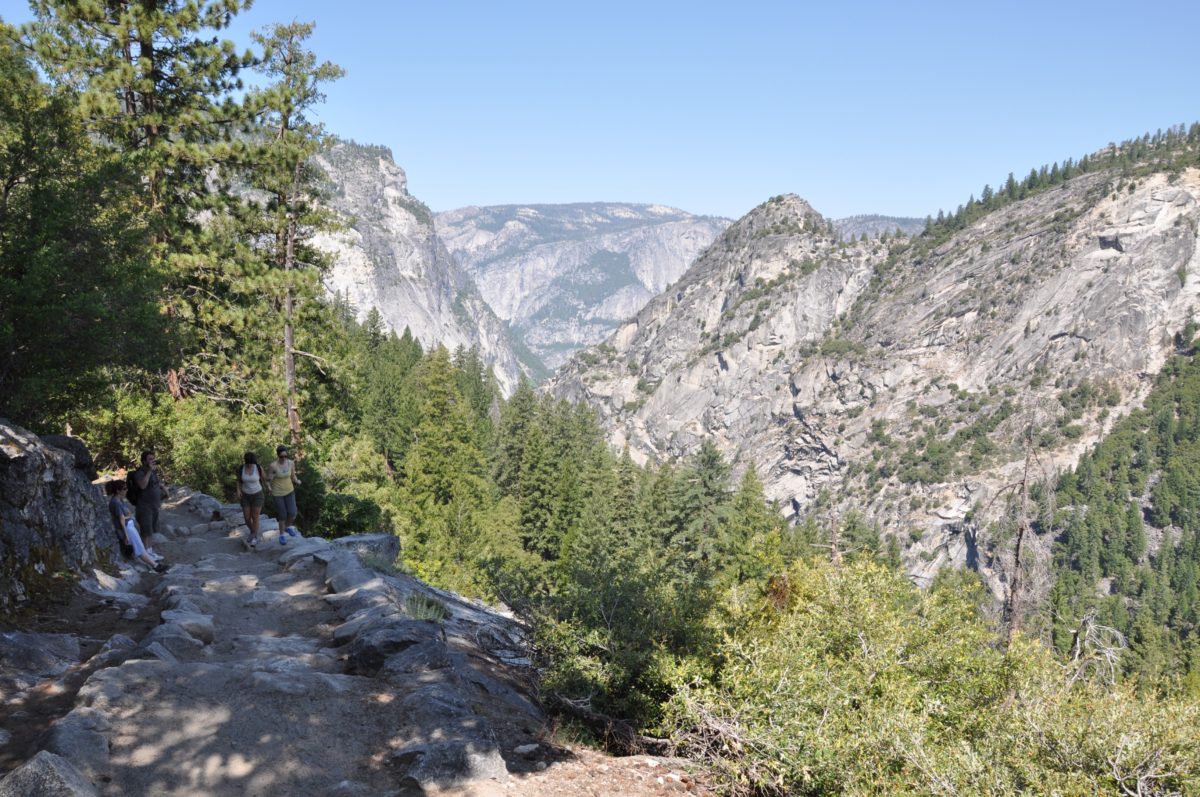
Section 2: The JMT To The Panorama Junction (2.3 Miles)
From the fork in the trail, keep right to continue 1 mile onto Clark Point.
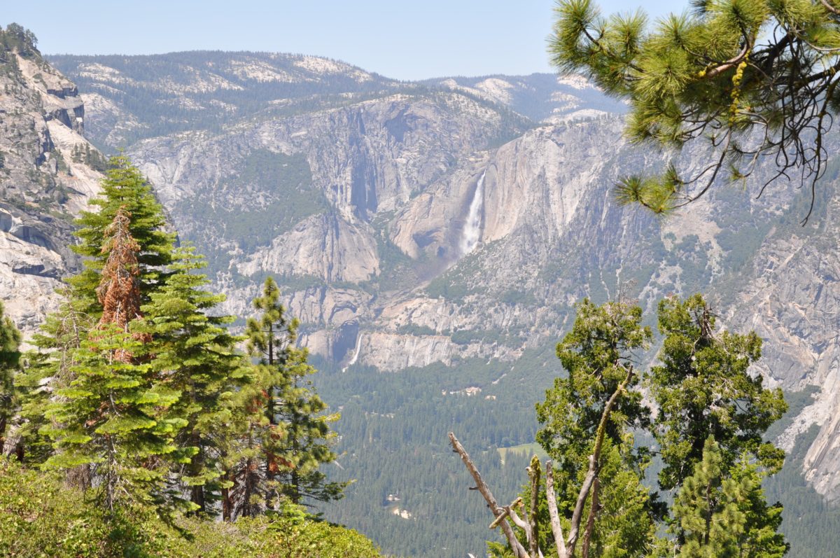
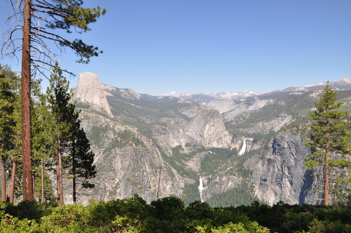
At Clark Point, hikers are rewarded with views of Half Dome, Nevada Fall, and Liberty Cap.
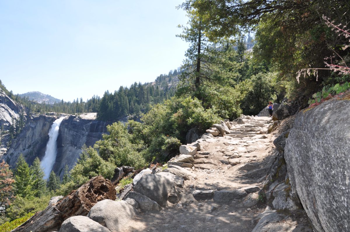
The trail from Clark Point to Nevada Fall hugs a cliffside providing some of the most scenic views of the entire trail.
The view back down the trail toward Yosemite Fall (in Yosemite Valley)
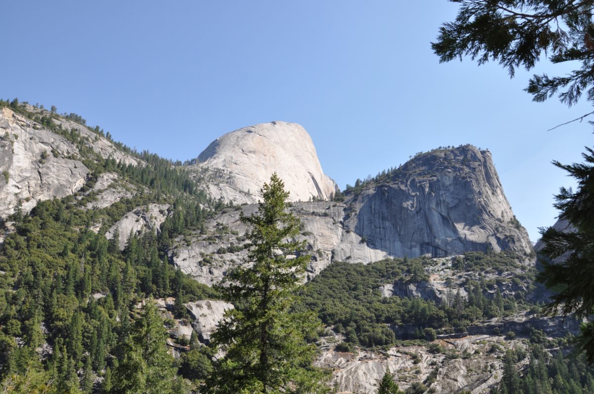
The first glimpse of [the backside of] Half Dome
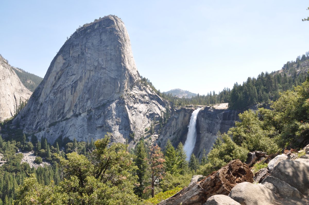
The Liberty Cap and Nevada Fall just past Clark Point
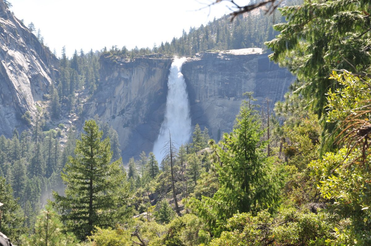
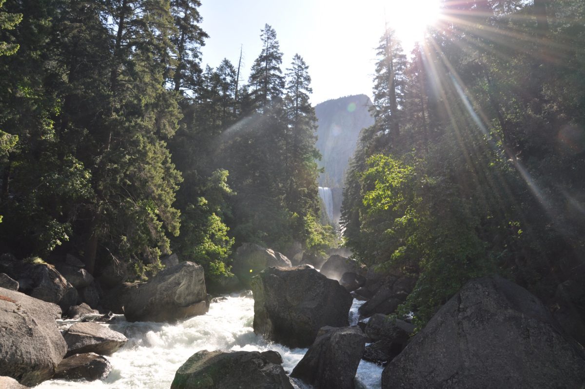
About here is where you can really start to hear the roar of Nevada Fall
Taking in the views!
Looking back down the JMT
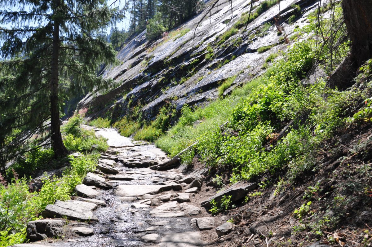
Nearing the junction with the Panorama Trail
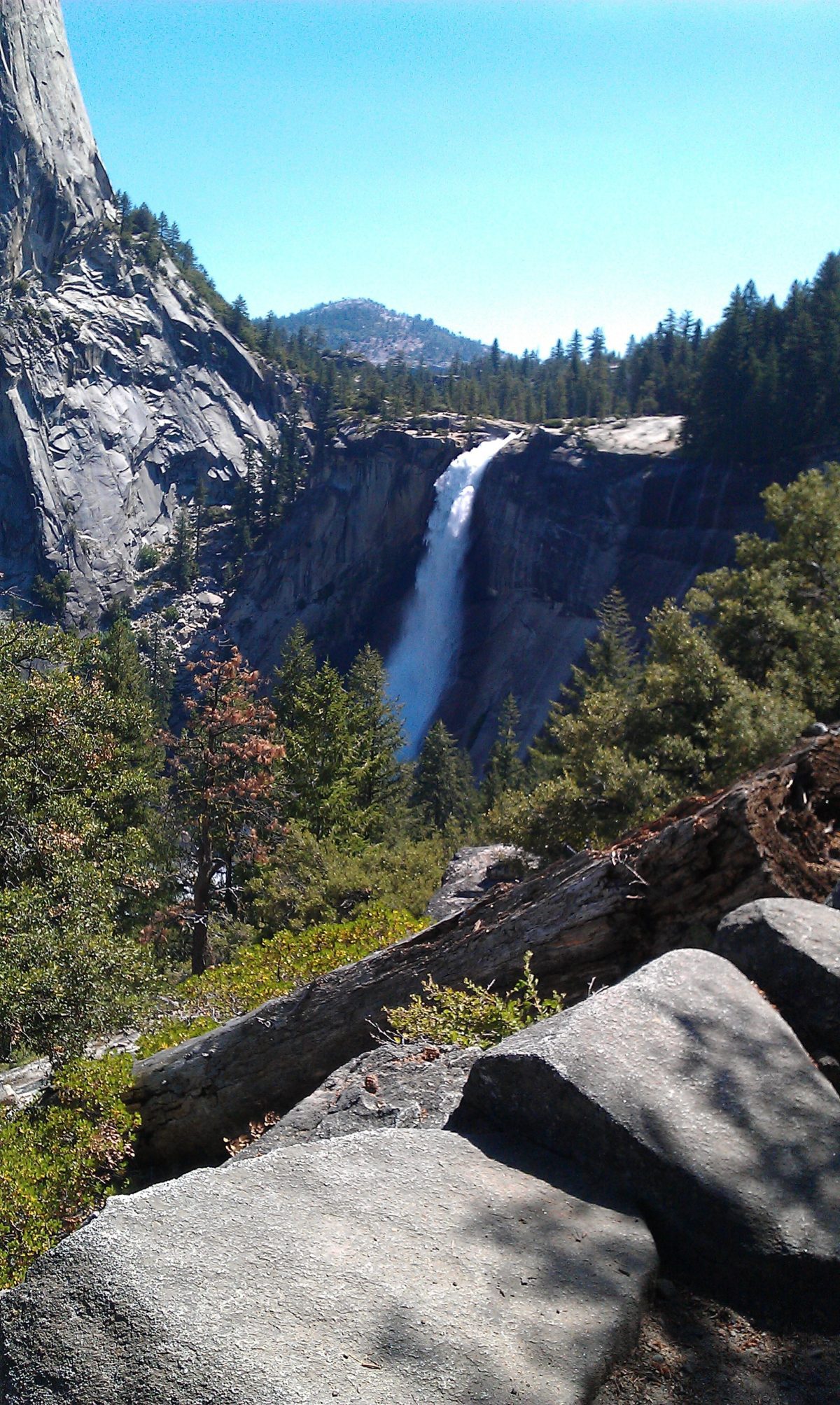
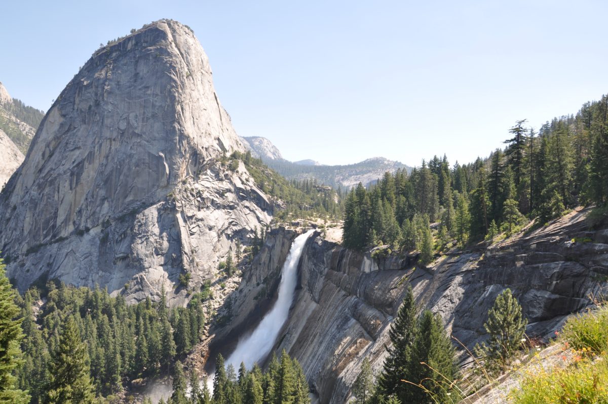
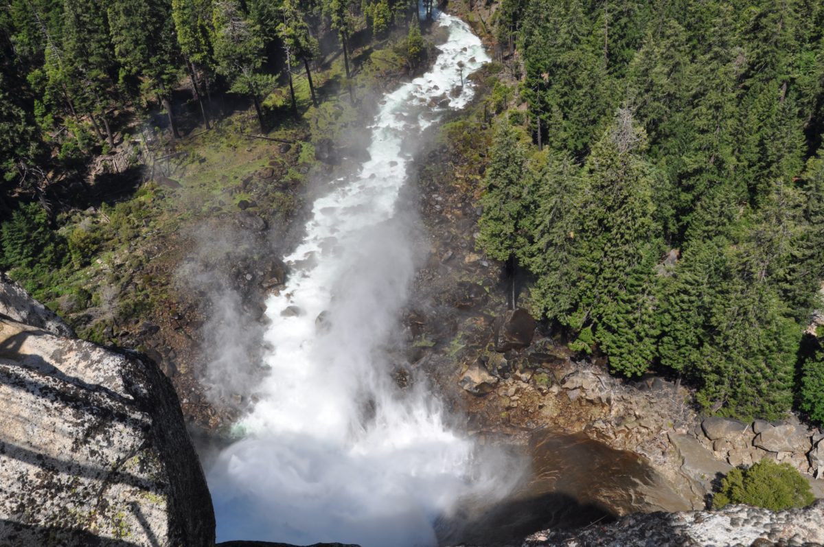
Nevada Fall in all its glory!
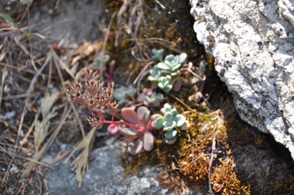
Native succulents call this section home
Section 3: Nevada Fall
From the junction of the JMT and the Panorama trail, keep left to head over the one of this trail’s main attractions – the top of Nevada Fall.
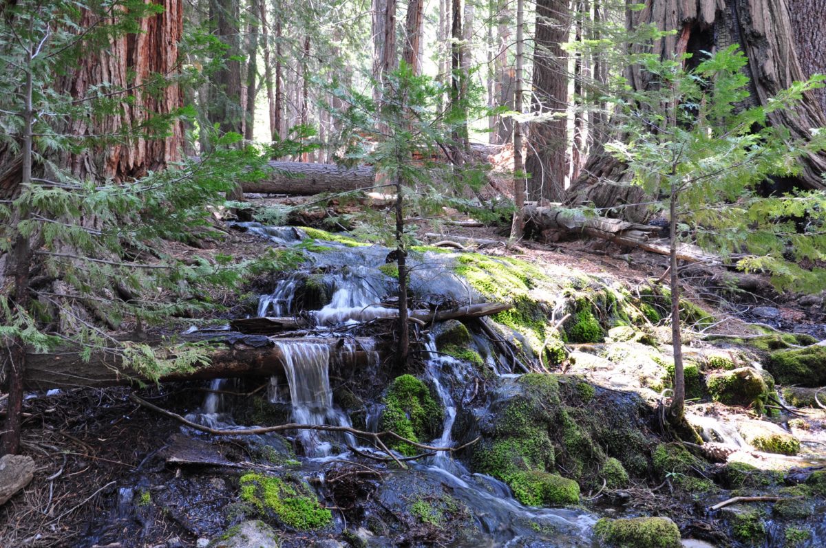
The first part is a lush, moist section of shaded forest that gives way to open views once you near the Merced River.
The trail leads over a footbridge at the top of the falls and then to several incredible viewpoints looking down from the waterfall.
FHOP Tip: By the time hikers reach Nevada Fall, they will have climbed to an altitude of 6,000 feet. Thus, for many hikers, Nevada Fall is the ideal place to take in the views while enjoying a well-deserved lunch break.
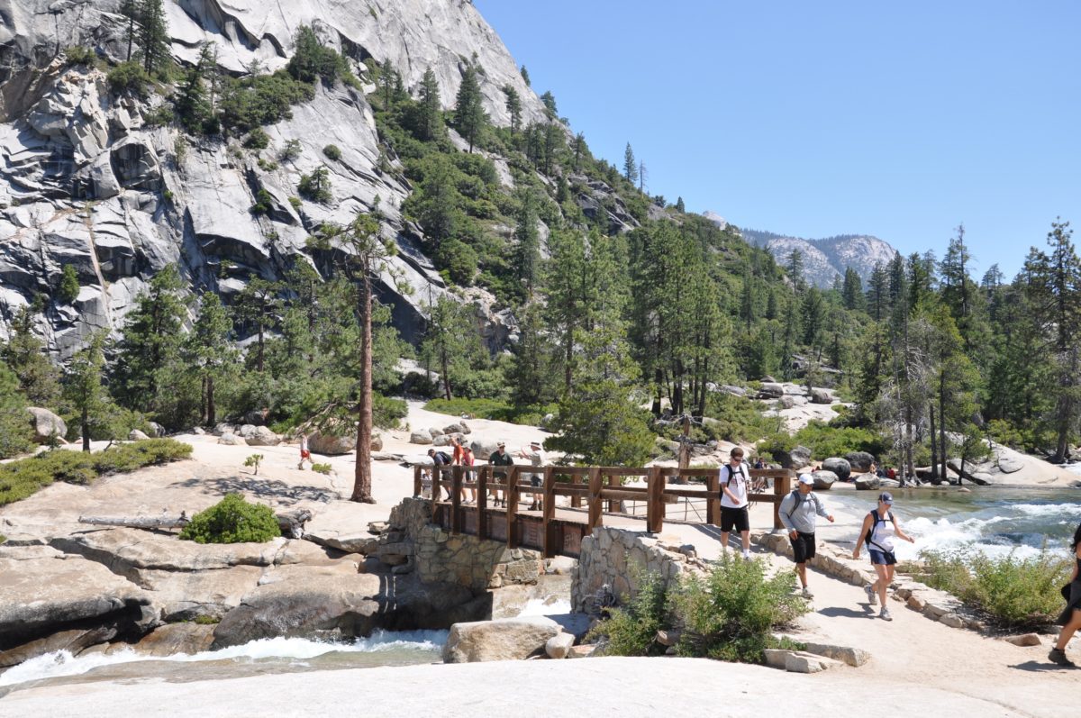
The footbridge over the Merced River
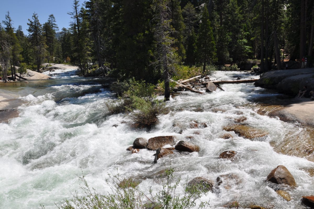
The Merced River (right before it plunges over the fall)

“Living the dream” at the top of the waterfall
The view…straight down!
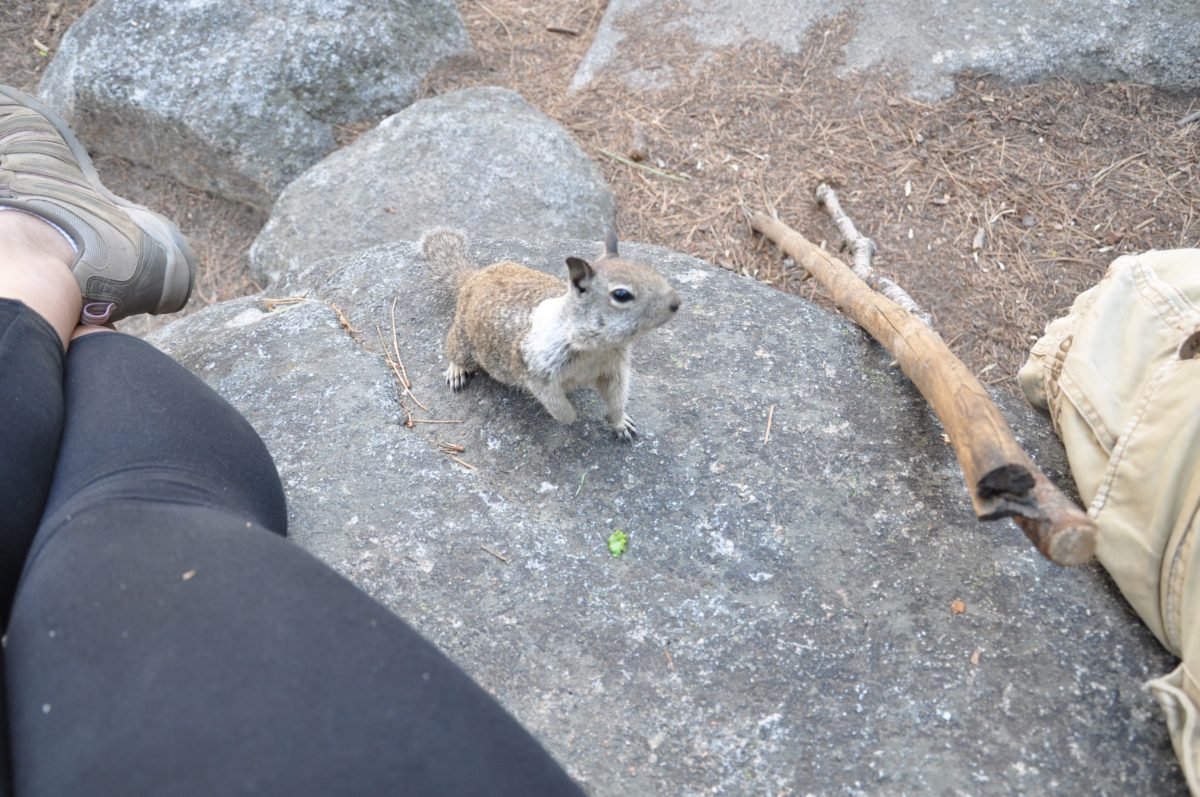
A thief trying to steal some Cheetos.
Section 4: Nevada Fall To The Panorama Trail Junction
From the top of Nevada Fall, the trail backtracks to the Panorama junction with the JMT.
Follow the signage to hop on the Panorama trail.
Just when you think most of the uphill hiking is behind you, the Panorama Trail hits you a with rude and steep awakening, as the trail climbs up a large hill via a diabolical series of switchbacks.
Once you reach the top of the hill, you can rejoice. The hardest part of this entire loop trail is now officially behind you.
Continue on until you reach the next junction.
Section 5: The Panorama Trail To Illilouette Fall Junction (2.6 Miles)
The junction of the Panorama trail marks the beginning of another of this trail’s highlights, the many stunning views from the aptly-named Panorama Trail.
FHOP Tip: For some reason, the section of trail to Illilouette Fall always seems to be full of mosquitos – the nasty, mountain mosquito variety – that can bite through clothing. Be sure to have mosquito repellant readily available if need be.
Before you get to Illilouette Fall, keep your eyes peeled for an unmarked “goat trail” that veers off to the right through a low patch of manzanita brush. This is the infamously hidden Panorama Point.
You’ll have to walk off the Panorama Trail for several meters to arrive at the viewpoint which lies at the edge of a cliff. Don’t worry, it’s safe as long as you don’t stand too close (although it does help to have 100% trust in the people standing behind you).
Soon, the trail leads down to the footbridge near Illilouette Fall.
Note: Illilouette Fall is not visible from the Panorama Trail. However, for the adventurous, there is a viewpoint that may be accessed off the Panorama Trail, though it is unmarked (and quite sketchy).
Panorama Point is just up ahead!
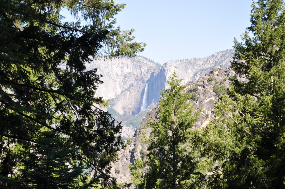
Upper and Lower Yosemite Falls
It’s a long way down to the Merced River from Panorama Point
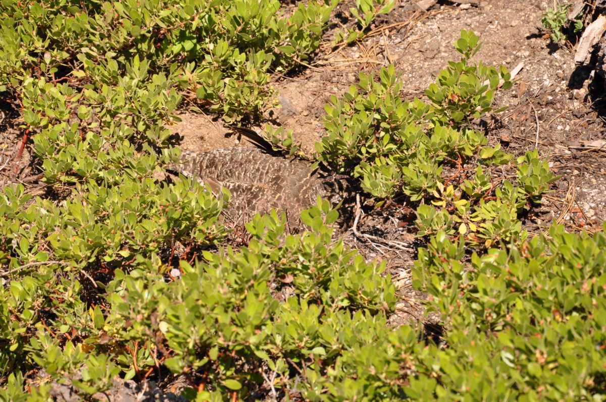
A large Grouse hiding on the ground among the Manzanita brush at Panorama Point
More views from Panorama Point
The Illilouette footbridge
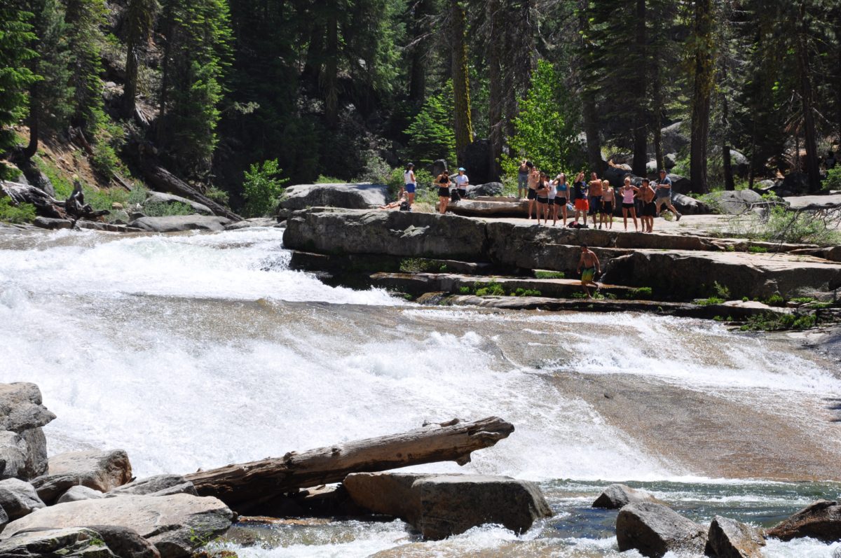
Crowds at Illilouette. Remember, you should never swim above a waterfall!
Section 6: The Panorama Trail Junction To Glacier Point (1.5 Miles)
After the Illilouette footbridge, there is another junction.
Keep right to follow the Panorama Trail upward to Glacier Point.
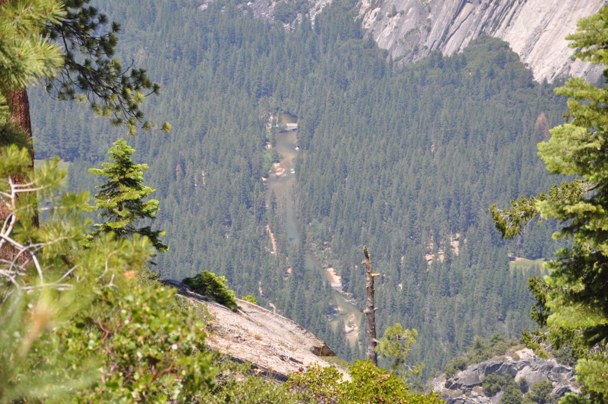
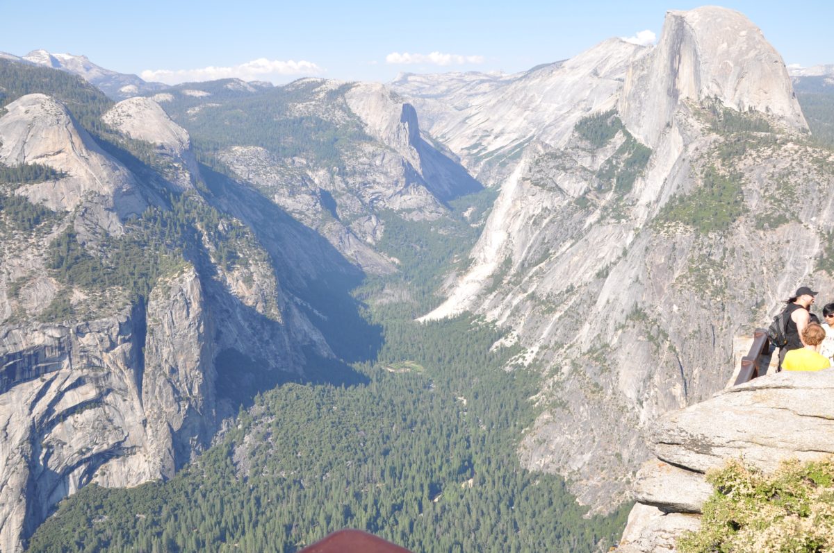
This section of trail seems to trek along an impossible cliff side with sheer drop-offs, but it’s wide and provides amazing views of Yosemite National Park, Little Yosemite Valley, and Half Dome.
Looking back down the trail toward Illilouette Fall
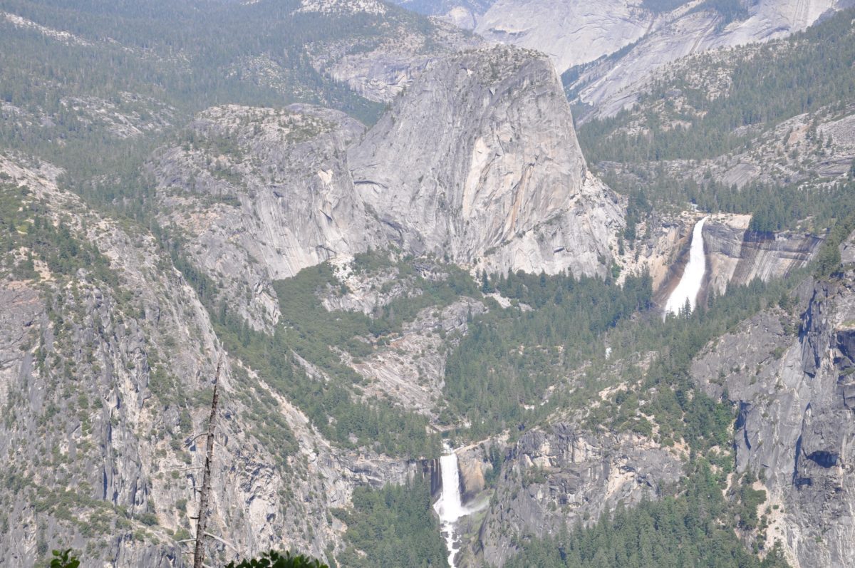
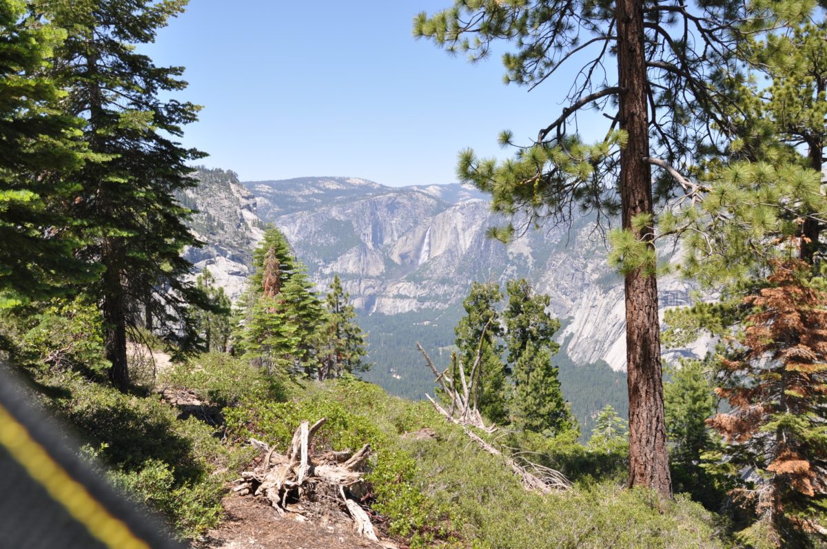
Little Yosemite Valley: Vernal Fall and Nevada Fall
View of the hike you just did…several hours ago!
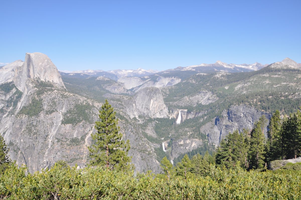
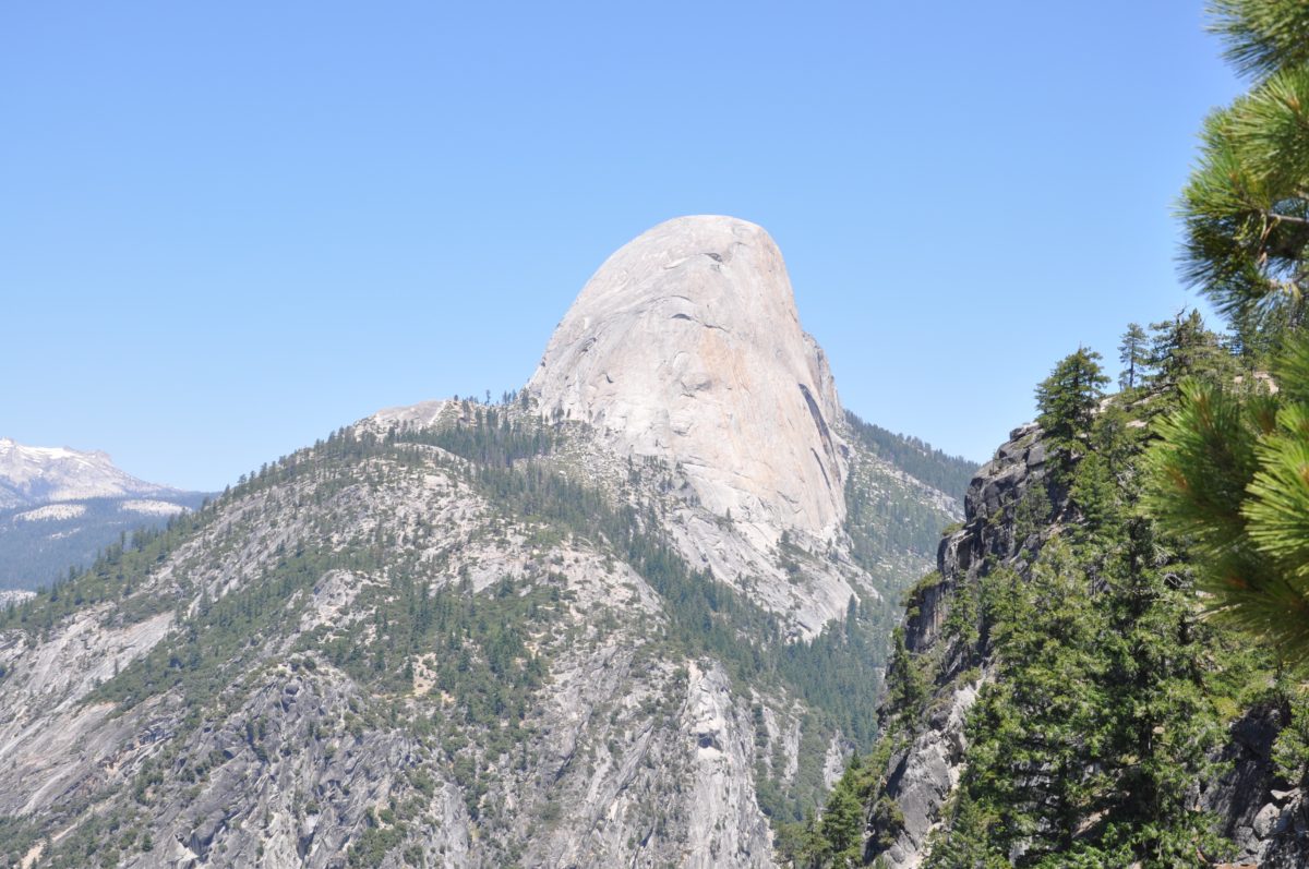
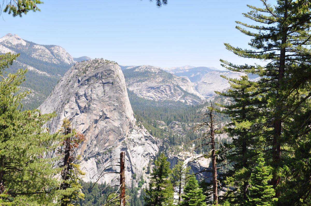
The iconic flat edge of Half Dome comes into view (far left)
Almost to Glacier Point!
Glacier Point
The Panorama Trail ends at one of the best viewpoints in the park (and the world), Glacier Point.
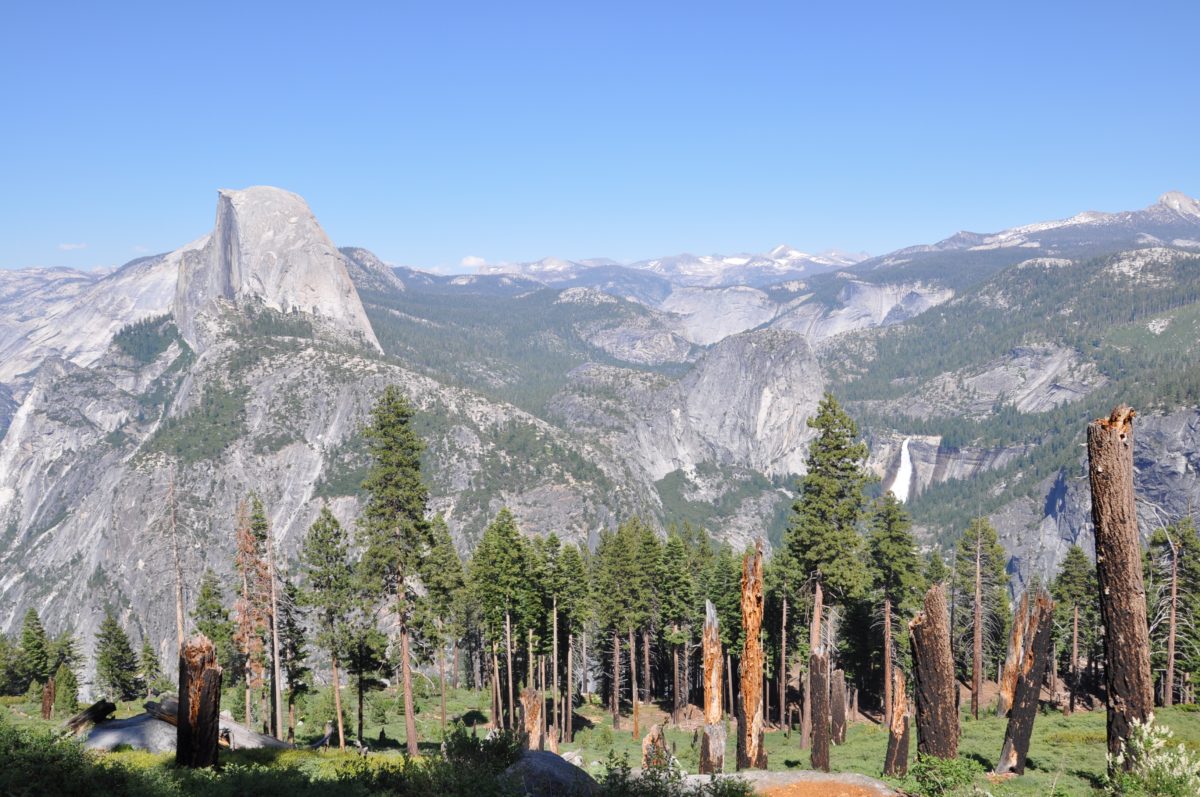
From this vantage point, you’ll have views of Half Dome, Cloud’s Rest, North Dome, Tenaya Canyon, Yosemite Fall, and Yosemite Valley.
FHOP Tip: If you start early enough, you may just reach the little gift shop at Glacier Point before it closes. If you do, you are in for one of the greatest treats known to mankind – ice cream at Glacier Point! It’s the perfect reward for the grueling hike you would have just endured and conquered!
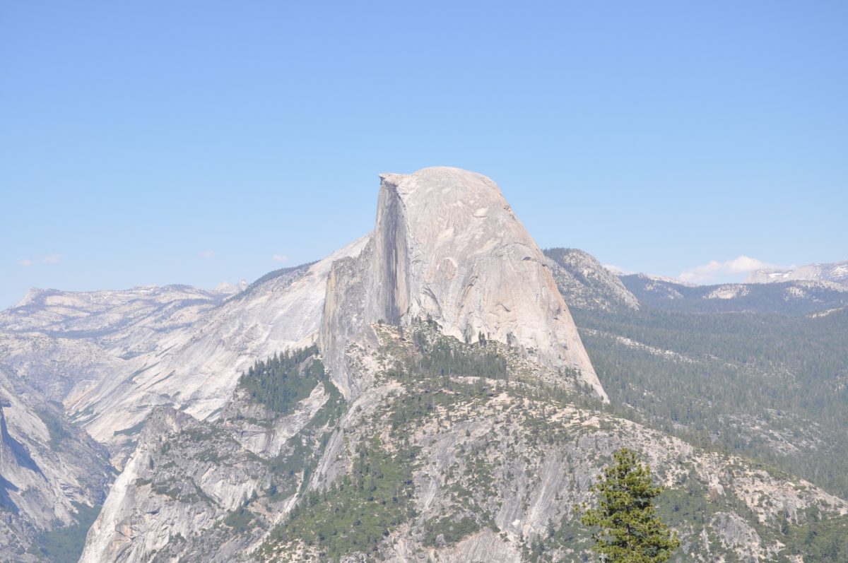
Half Dome
Tenaya Canyon
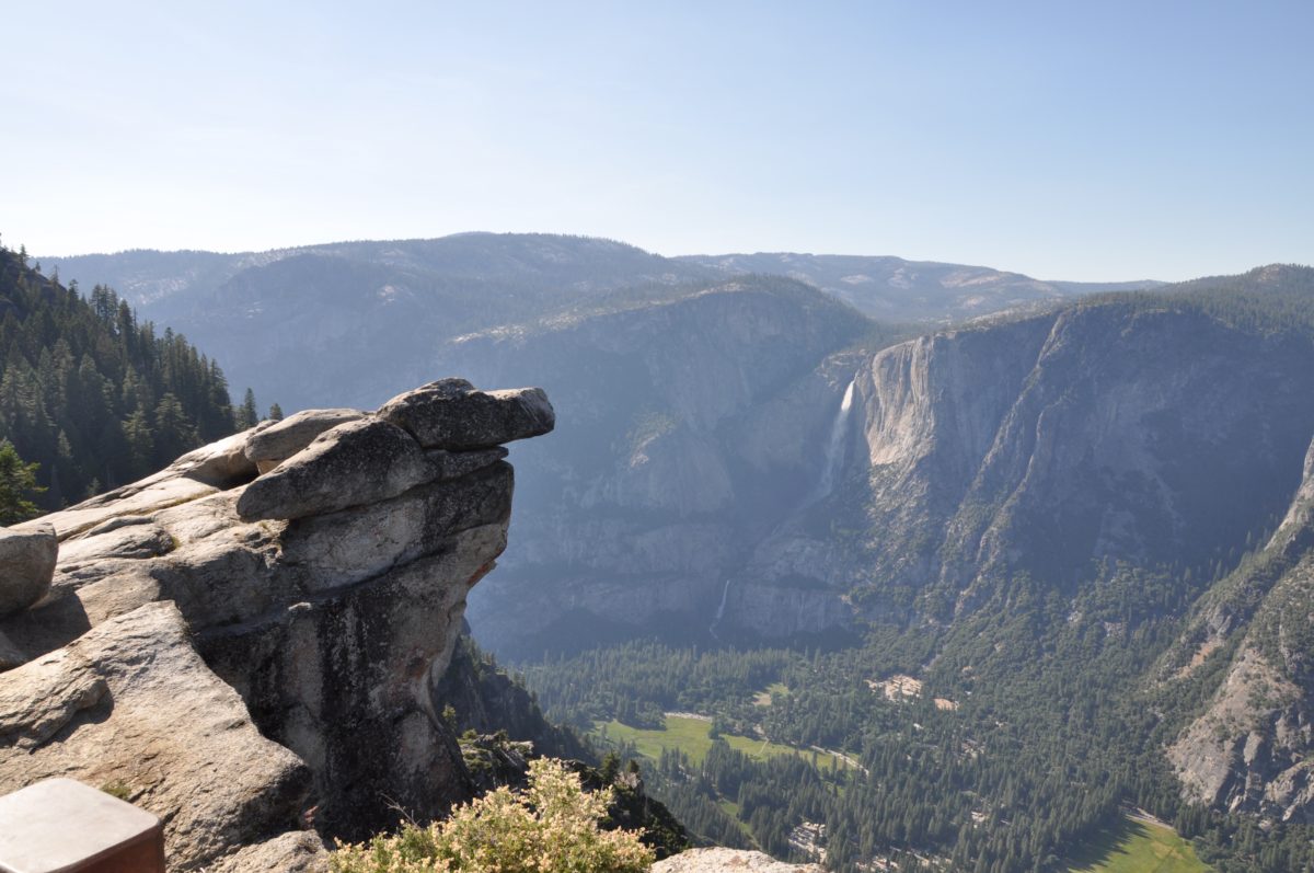
Yosemite Fall
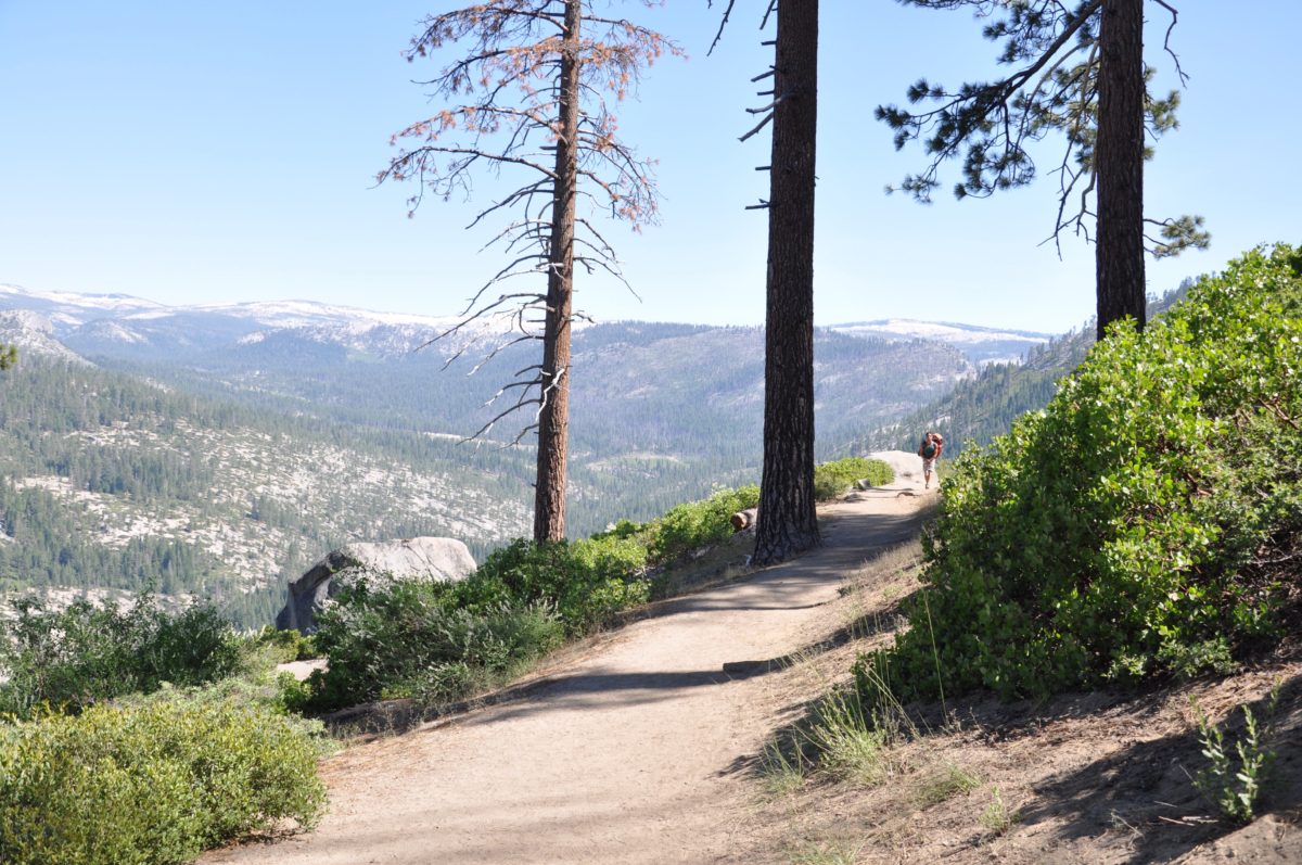
Section 7: The Four Mile Trail (4.8 Miles)
After taking a long well-deserved break at Glacier Point, you are ready to hit the last remaining section of the loop hike, the Four Mile Trail (which is really closer to 5 miles).
Follow the signage from Glacier Point to find the trailhead to the west.
The first section of this trek is a long, flat, and straight walk through the woods.
However, things change rather quickly once the trail starts its rapid descent via a series of tight and steep switchbacks.
Although the trail is still “standard width”, the fact that the switchbacks below you are not visible for much of this section can be a bit vertigo-inducing.
Rest assured, the trail is well engineered and safe. Take in the dramatic views westward as you descend in to the Valley.
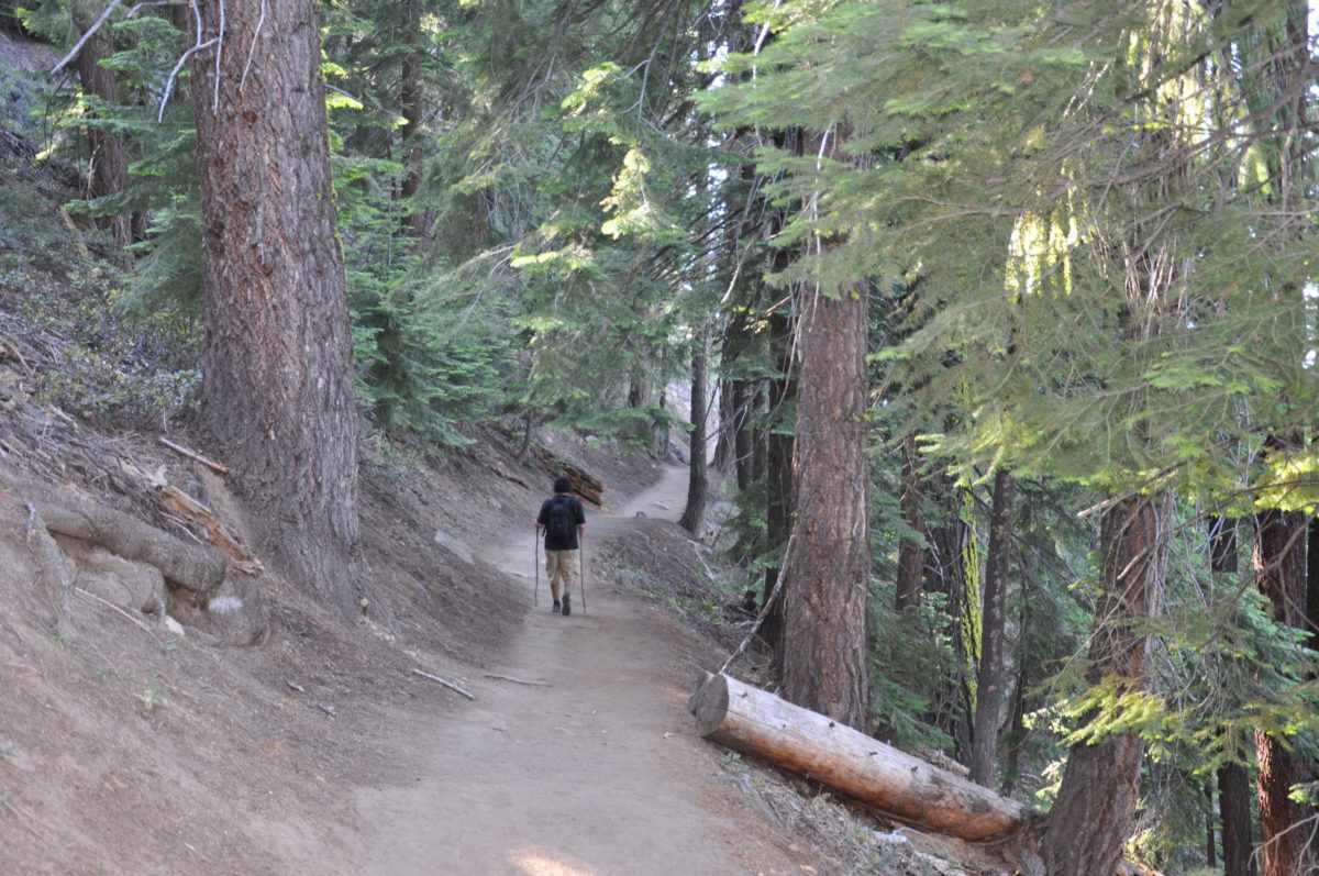
The first straight-away is a flat and shaded walk through the woods
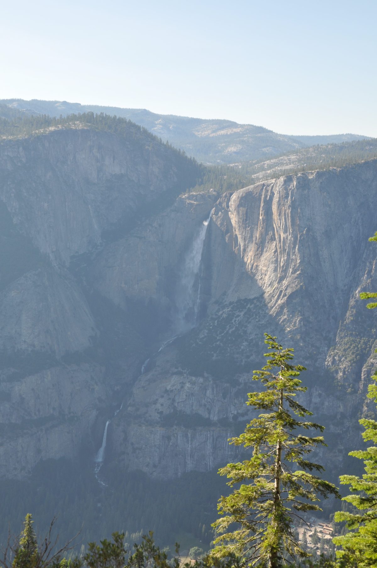
Upper and Lower Yosemite Falls (as sunset nears)
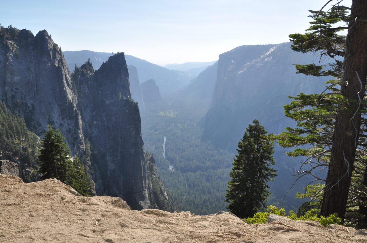
The switchback section provides awe-inspiring views of Yosemite Valley, including Cathedral Rocks, El Capitan, and the Merced River
Section 8: The Four Mile Trailhead Back To The Parking Area
The mileage of the final section will vary depending on where you parked your vehicle or where you are staying for the night.
If you took my advice and parked at Swinging Bridge, you should be relaxing in the comfort of your own vehicle in “no time”. If you didn’t, you may have several miles yet to hike.
Final Thoughts: Hiking The Panorama Loop Trail [Via The JMT]
To this day, I think the Panorama Loop Trail is a top contender for the “best day hike in the world”. Yes, it’s that good.
It’s certainly my favorite day hike in Yosemite National Park, hands down.
The trail has everything including incredible natural landmarks, thundering waterfalls, and apex wildlife viewing. It’s at once challenging and conquerable, tame and wild, customizable and rigid, and safe and dangerous.
I personally credit this trail with bestowing on me the “religion” of hiking.
It’s one of those rare things in travel that I believe everybody should experience at least once in their lives (if they can).
Cheers!
*(H/T yosemitehikes.com)