
Editor’s Note: This post is part my series on Las Vegas area Hikes. Also, click here for more information on all things Las Vegas.
Having already tried – and failed – 3 times to secure a permit for “The Wave“, I was pretty bummed-out when I came to the realization that I may never get to see such an awesome “wave-like” desert formation in my lifetime.
Well, that was until I heard of the Fire Wave Trail in Nevada’s Valley Of Fire State Park.
Hiking The Fire Wave Trail, Valley Of Fire State Park (Las Vegas, Nevada)
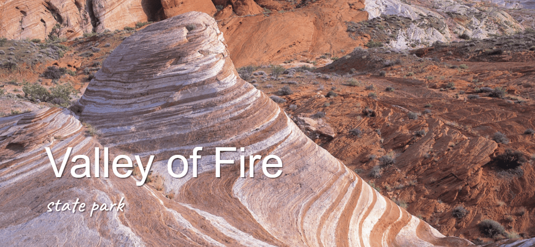
Image courtesy of parks.nv.gov
About The Fire Wave Trail:
The Fire Wave Trail is a spectacular 1.5 mile out-and-back trail that takes you from the White Domes parking lot (P3), past a large rock formation with a slanted rock nick-named “Gibraltar Rock”, to the area known as the Fire Wave.
The trail itself is well-marked and easy to follow, although you may have to keep you eyes open for trail markers when hiking on the red-rock sections. This fully-exposed desert trail is sandy in some parts, rocky in others, and has almost no shade.
It does have some cool wildlife spotting opportunities and many awesome vantage points for pictures, with the highlight being the namesake Fire Wave.
This easy-to-moderate trail should take about 1-2 hours to complete and is good for people of all ages and skill levels. As this is a desert hike, you should have plenty of water as well as sunscreen, sunglasses and a hat before attempting this trail.
Hiking The Fire Wave Trail In Valley Of Fire State Park
Getting There: Valley of Fire State Park
The Fire Wave Trail is yet another awesome Las Vegas Hike. Who knew?
This trail is located in Nevada’s oldest State Park, the aptly named Valley of Fire, which is located about 1 hour from Las Vegas, Nevada.
Getting there is a bonus because it requires a drive down the Valley of Fire’s most scenic route, White Domes Road (aka Mouse’s Tank Road).
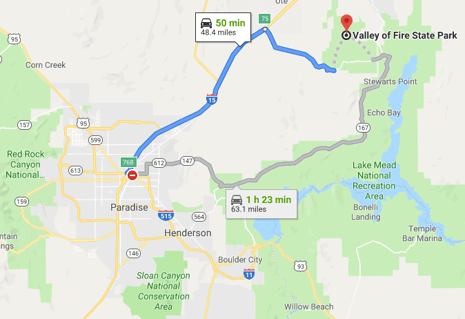
The Valley of Fire is located about 1 hour from Las Vegas
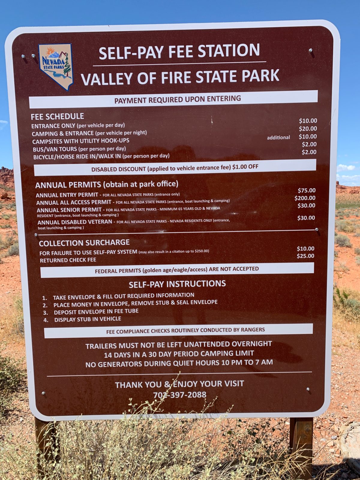
Valley Of Fire Park Entrance Information:
The entrance fee is $10 per car. Sorry, this is a State Park, so your National Parks Pass won’t work here.
FHOP Tip: Although there are credit card stickers all over the booth, and they officially say they do accept credit cards, in reality and practice, they don’t. They’ll always tell you “sorry, the internet connection is down”. Save yourself the heartache and just plan on paying with cash.
The Official Park Map:
After paying the fee, you’ll be handed the official park map (below).
Note the Fire Wave trail is a newer hike, so it doesn’t appear on many maps, including the Park’s official website trail map. Luckily for you, you will find it on the official park map you get at the park entrance.
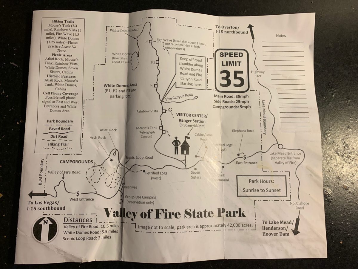
The Valley of Fire Map, with the Fire Wave Trail at the top/center/left
Parking For The Fire Wave Trail:
The parking lot for the trail is located at P3 (see the image below).
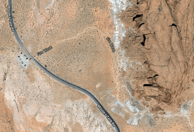
There is usually plenty of parking here as well as overflow and limited street parking (if need be).
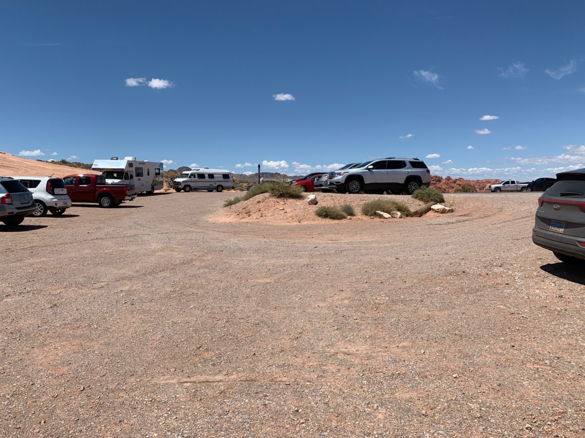
Thankfully, this is a large lot
The Fire Wave Trailhead:
The trailhead is located directly across the street (Mouse’s Tank Rd.) and is marked by a large trailhead sign.
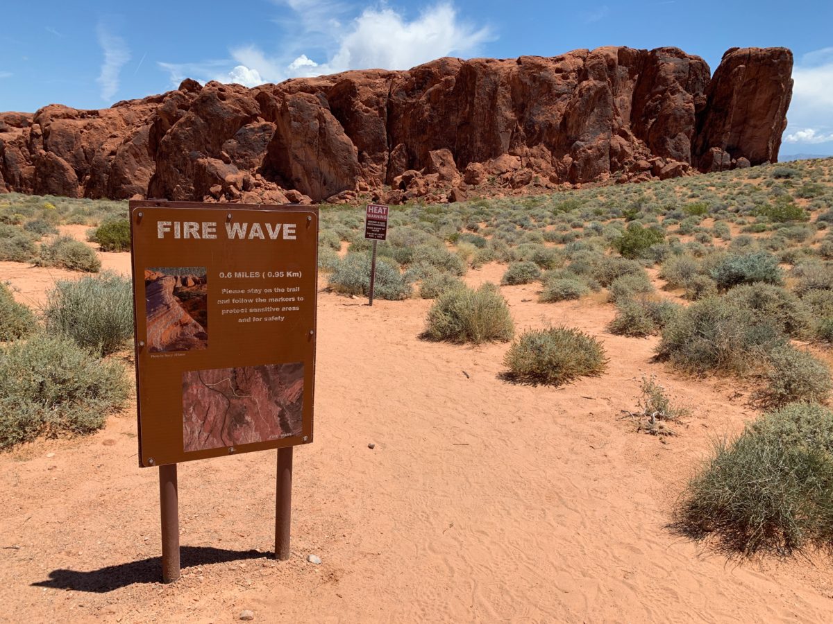
The trailhead sign (you can’t miss it) with a heat warning sign and Gibraltar Rock in the background
Section 1: Parking Lot To Gibraltar Rock
The first section of the trail is the most sandy stretch of this hike. You’ll navigate a sandy hill while heading straight for Gibraltar Rock.
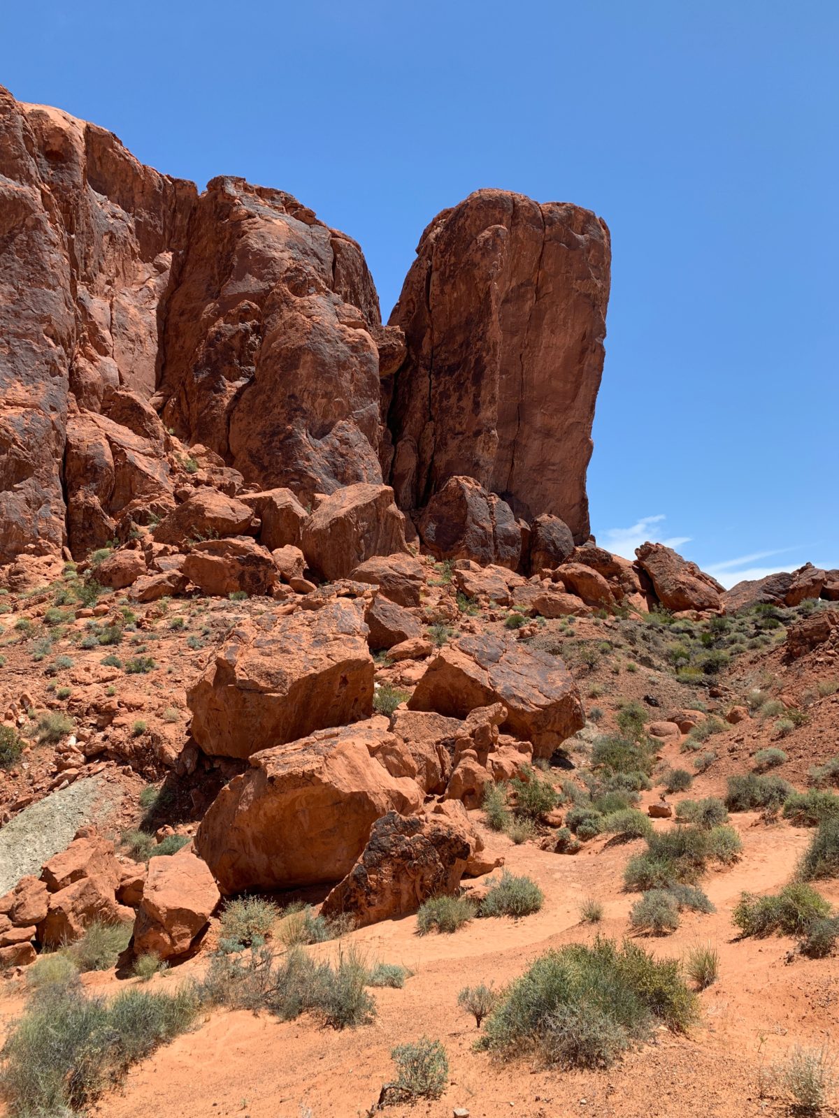
Gibraltar Rock
Section 2: The Desert Walk
Rounding Gibraltar Rock, you’ll get your first glimpse of the red-rock formations below.
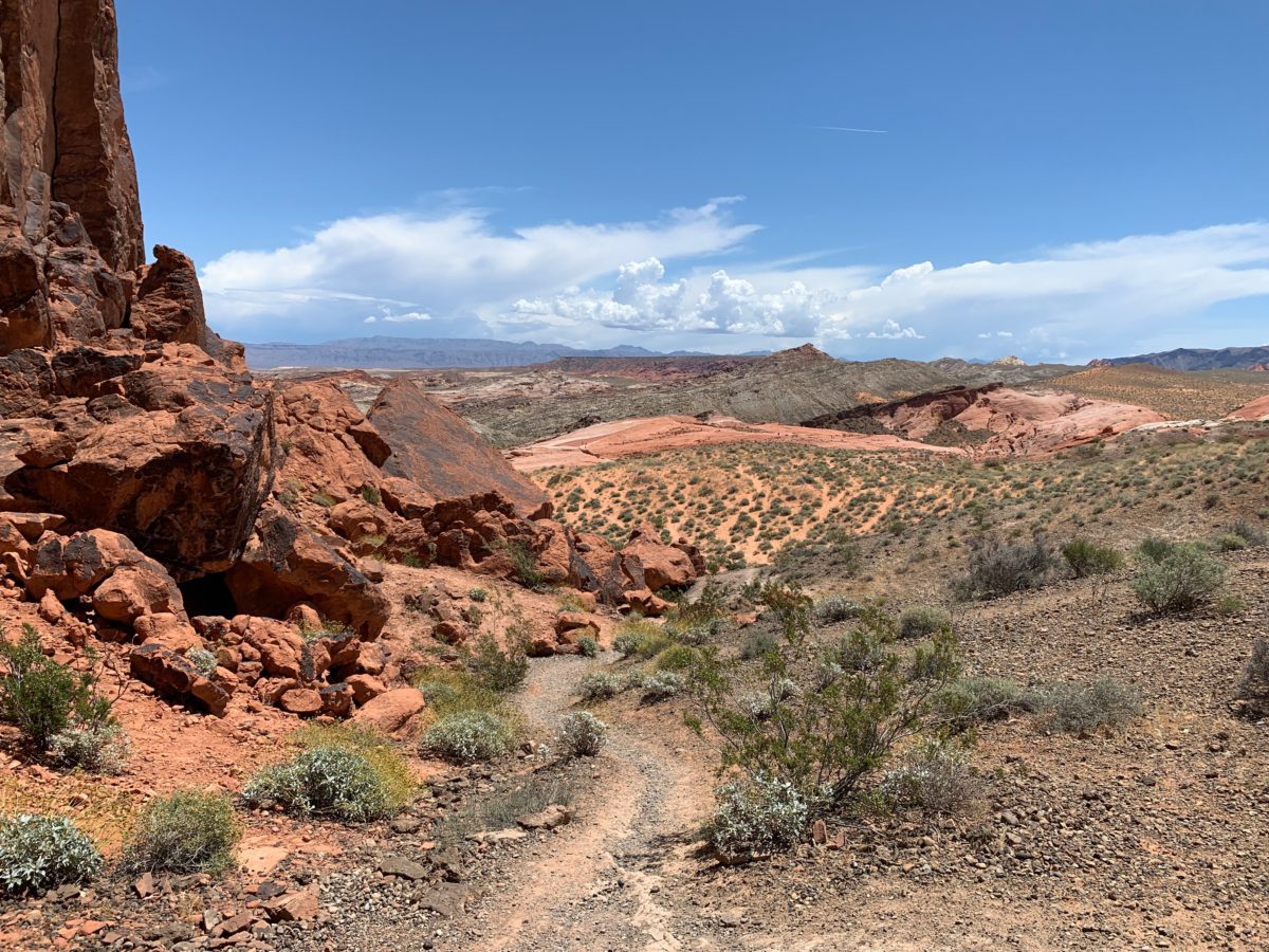
Heading down toward the Fire Wave
FHOP Tip: Keep your eyes peeled around Gibraltar Rock. I spotted this little Horned Lizard on the trail (below) and a large Desert Iguana (also below).
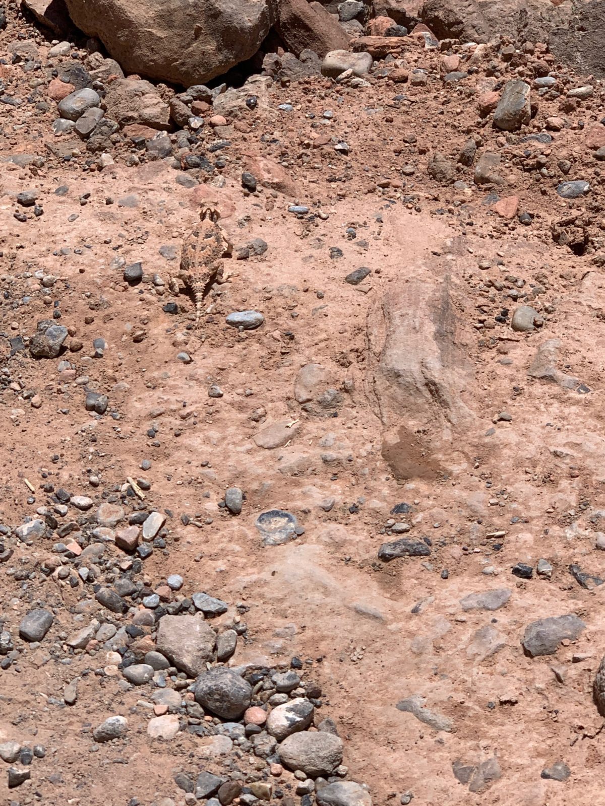
Look closely…did you see the “horny toad”?


A large Desert Iguana basking in the sun
A trail-marker to keep you on the straight-and-narrow
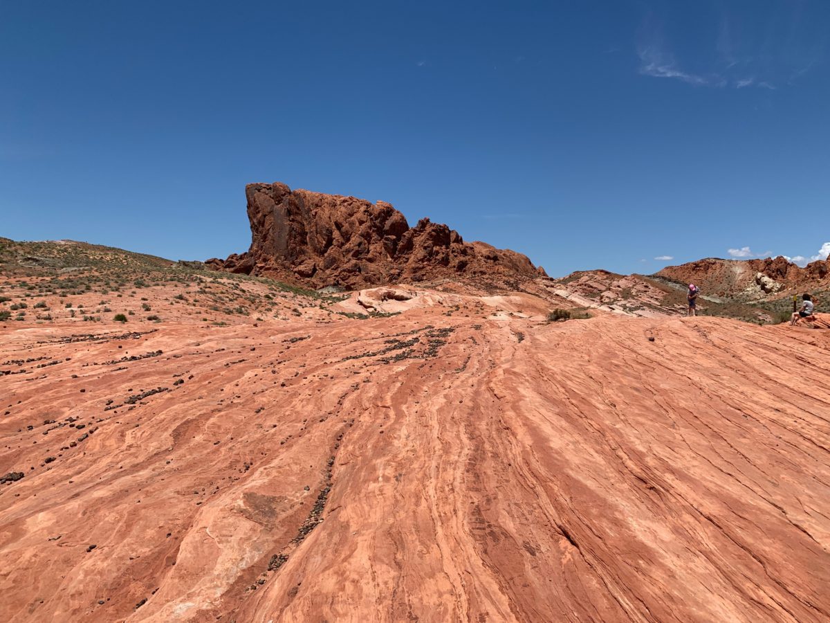
As last, you’ll set foot onto the red-rock sandstone formation
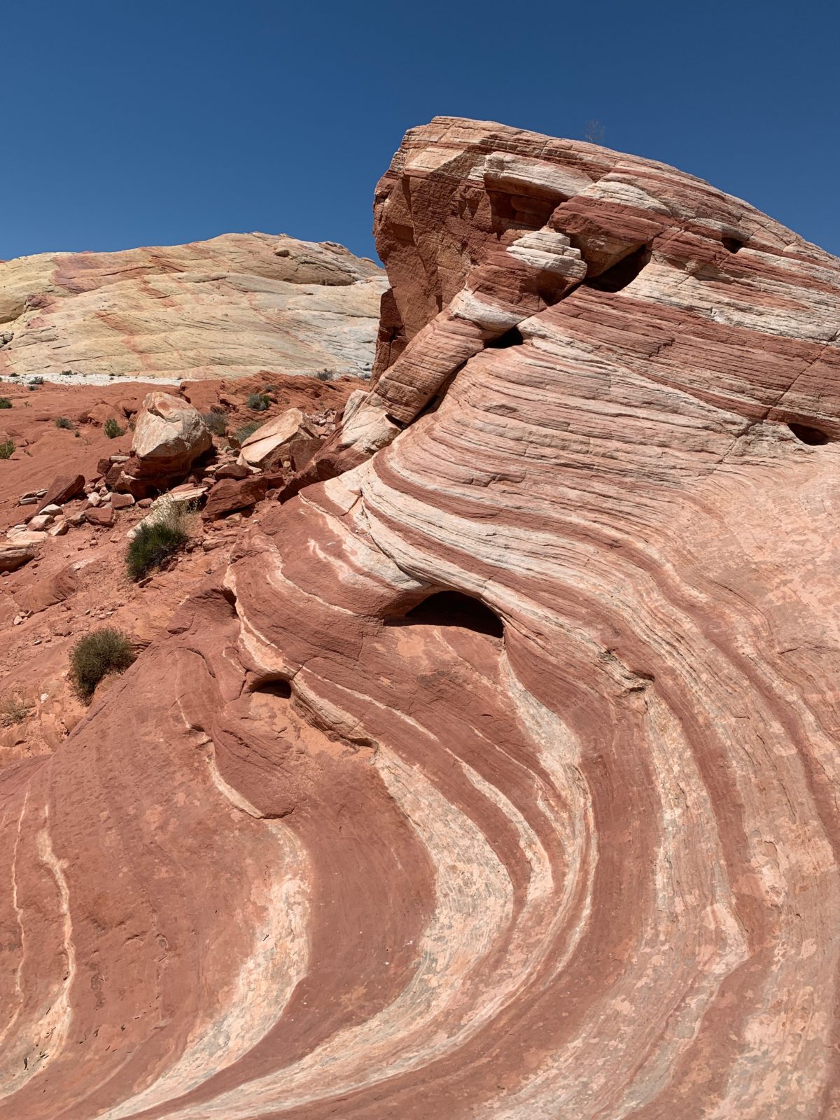
Section 3: The Fire Wave
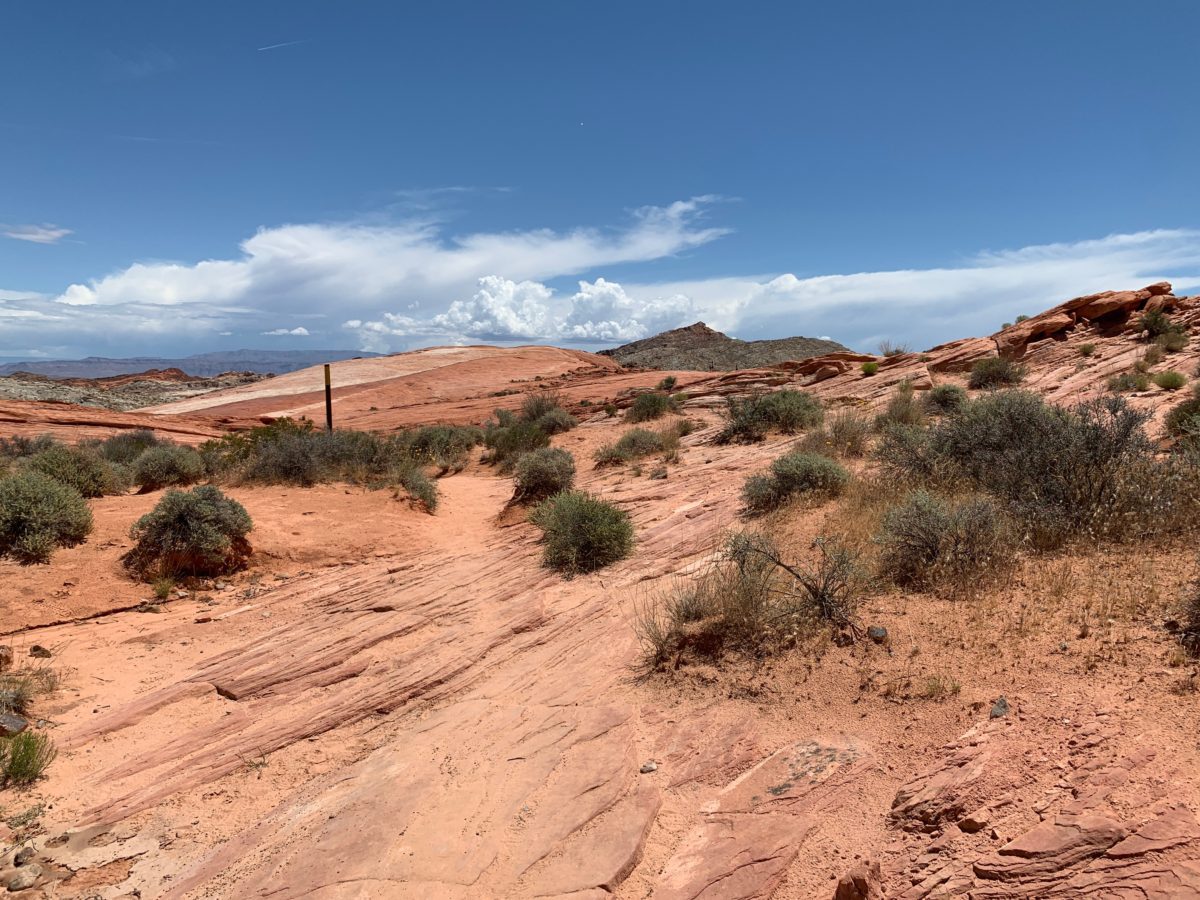
The trail will gently slope upward along the red-sandstone formation.
Looking backward (toward Gibraltar Rock)
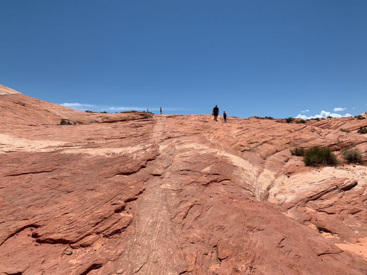
Looking forward: the trail is well-worn along the sandstone
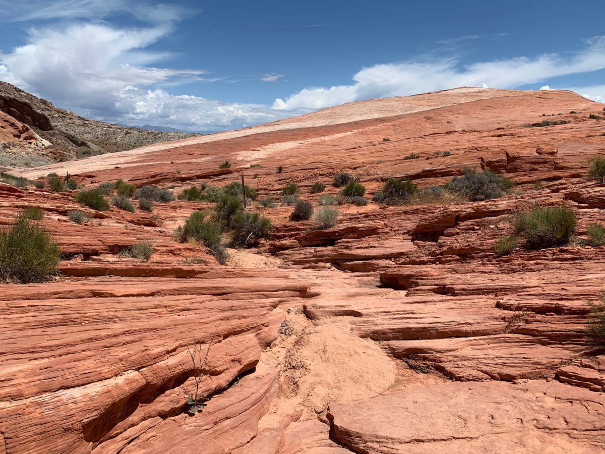
Here you may have to search for the odd rock-pile trail-marker, but don’t worry, the Fire Wave is located at the end of this formation (you can’t miss it).
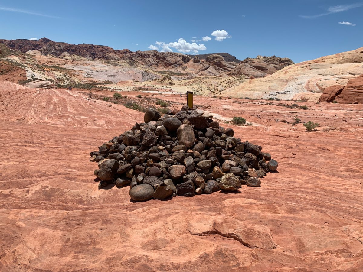
A rock-laden trail marker. Why ask why?
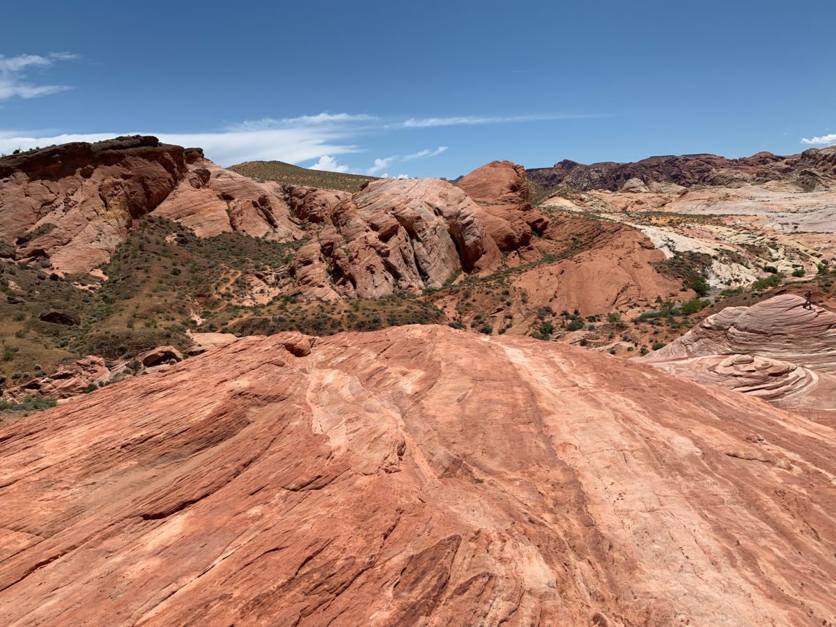
Straight-ahead! (Well, straight-ahead and down to the right)
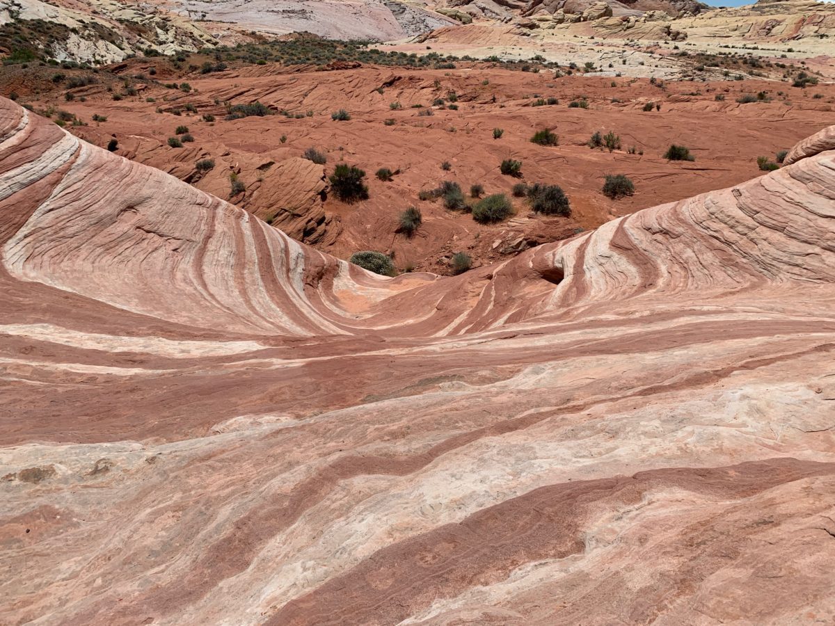
Soon, you’ll make it to the Fire Wave itself.
Take your time, enjoy every angle. There are many great pictures to be had – in every direction.
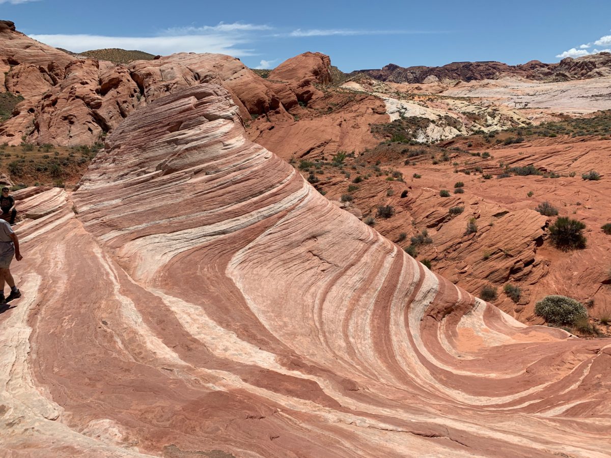
Behold, the Fire Wave!
Final Thoughts: Hiking The Fire Wave Trail, Valley Of Fire State Park (Las Vegas, Nevada)
This is a wonderful little hike in a truly amazing State Park.
I’ve been here several times, and every time I go, I’m in just as much awe as I was the first time. Everyone I’ve taken here has been equally impressed. It’s easy to see why. This trail is fun, relatively easy, and the Fire Wave at the end of the trail is a huge payoff.
If you haven’t been to the Valley of Fire yet, you are missing out – big time. There’s no better introductory hike to the Valley of Fire than the Fire Wave Trail.
Cheers!