
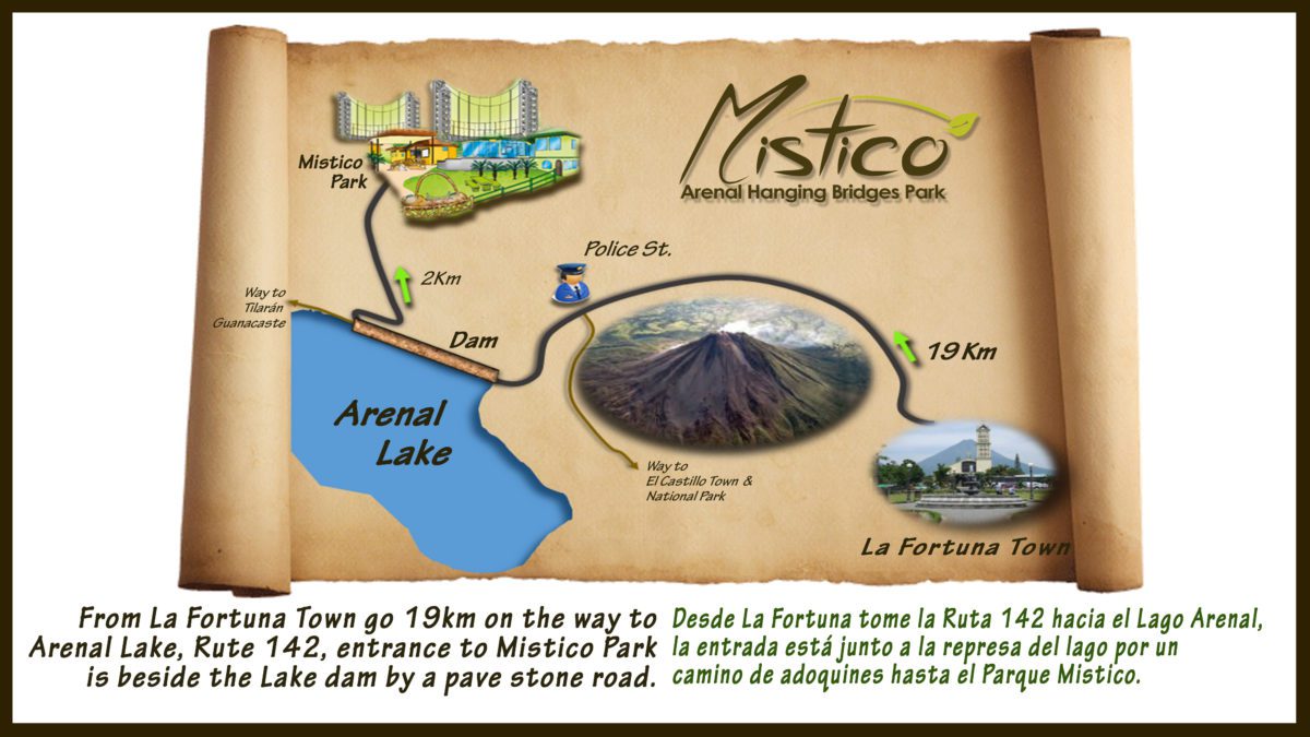
Earlier in the day, we did the Mistico Arenal Hanging Bridges Park and then hiked the La Fortuna Waterfall trail. After a brief stop back in La Fortuna Town for an excellent lunch of tacos, ceviche and cerveza at La Parada (on the south side of Fortuna Park), it was once again time to consult the Arenal area map.
Hiking the Arenal 1968 Trail(s):
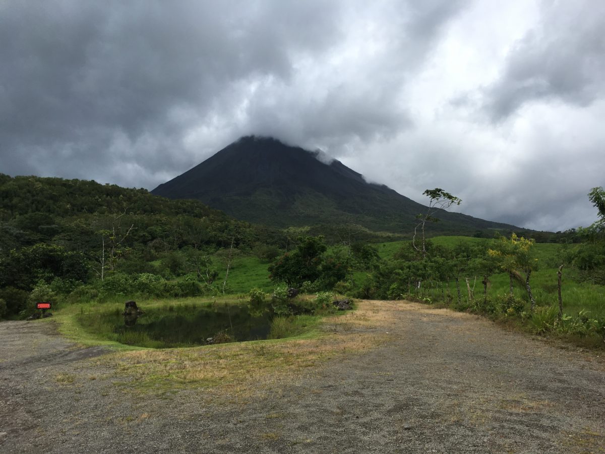
The final adventure of the day would be hiking the Arenal 1968 trail. This trail is named for the violent 1968 eruption that lasted 15 days (the last eruption of Arenal was 2010).
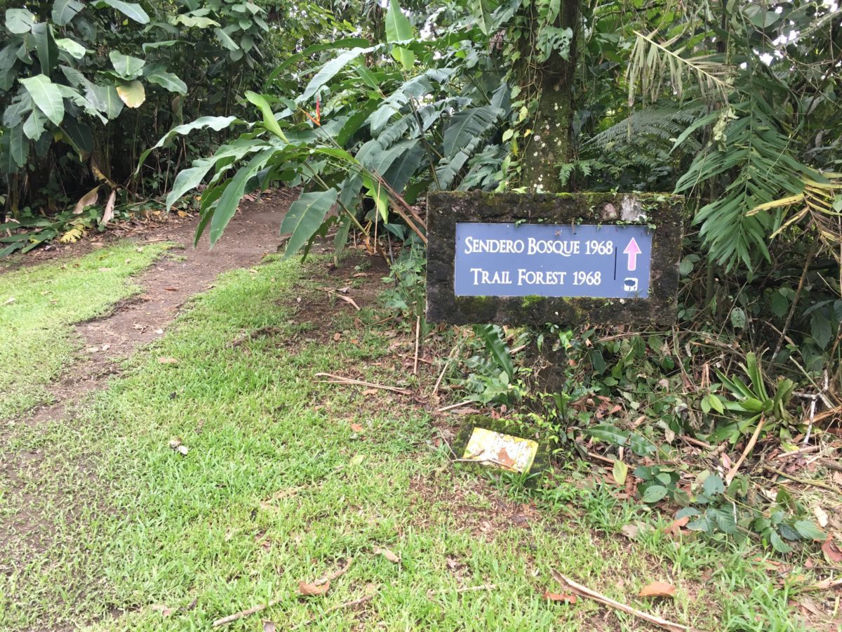
To reach the trailhead, drive toward the national park but turn off right before the national park entrance into a rocky parking lot marked “1968 Trail”. You’ll have to pay a usage fee of $12 a person, make sure to grab a copy of the map below.
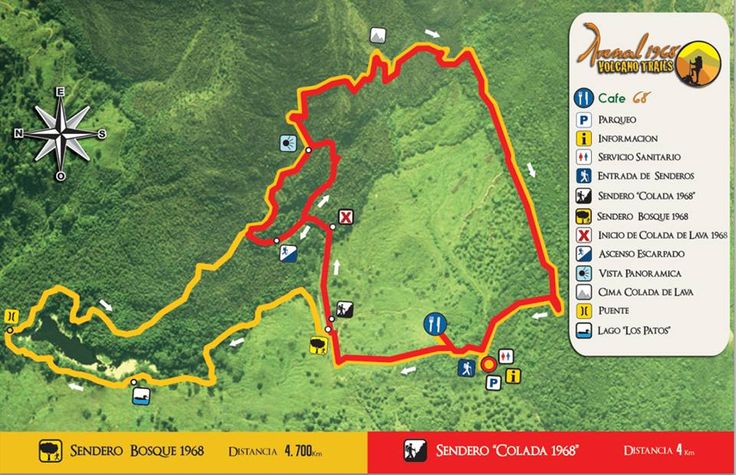
From the map above, you can see there are two trails: The “Bosque 1968” (yellow) trail and the “Colada 1968” (red) trail. When hiking the Arenal 1968 trail, you can do one or the other or combine them both. The map states the Bosque trail is 4.7km and the Colada trail is 4km. We went for the Bosque + Colada combo hike and figured it would take about 2.5 hours.
Starting Out: The Bosque Trail
Per the map, the Bosque trail flows in a clockwise direction as you head due north for the first leg to the lago “los patos” or “duck lake”.
The first thing you’ll come across when hiking the Arenal 1968 trail is a mini fruit plantation on the left. It not marked on the map, but it’s there.
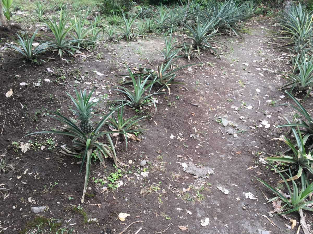
Oh, so that’s where pineapples com from
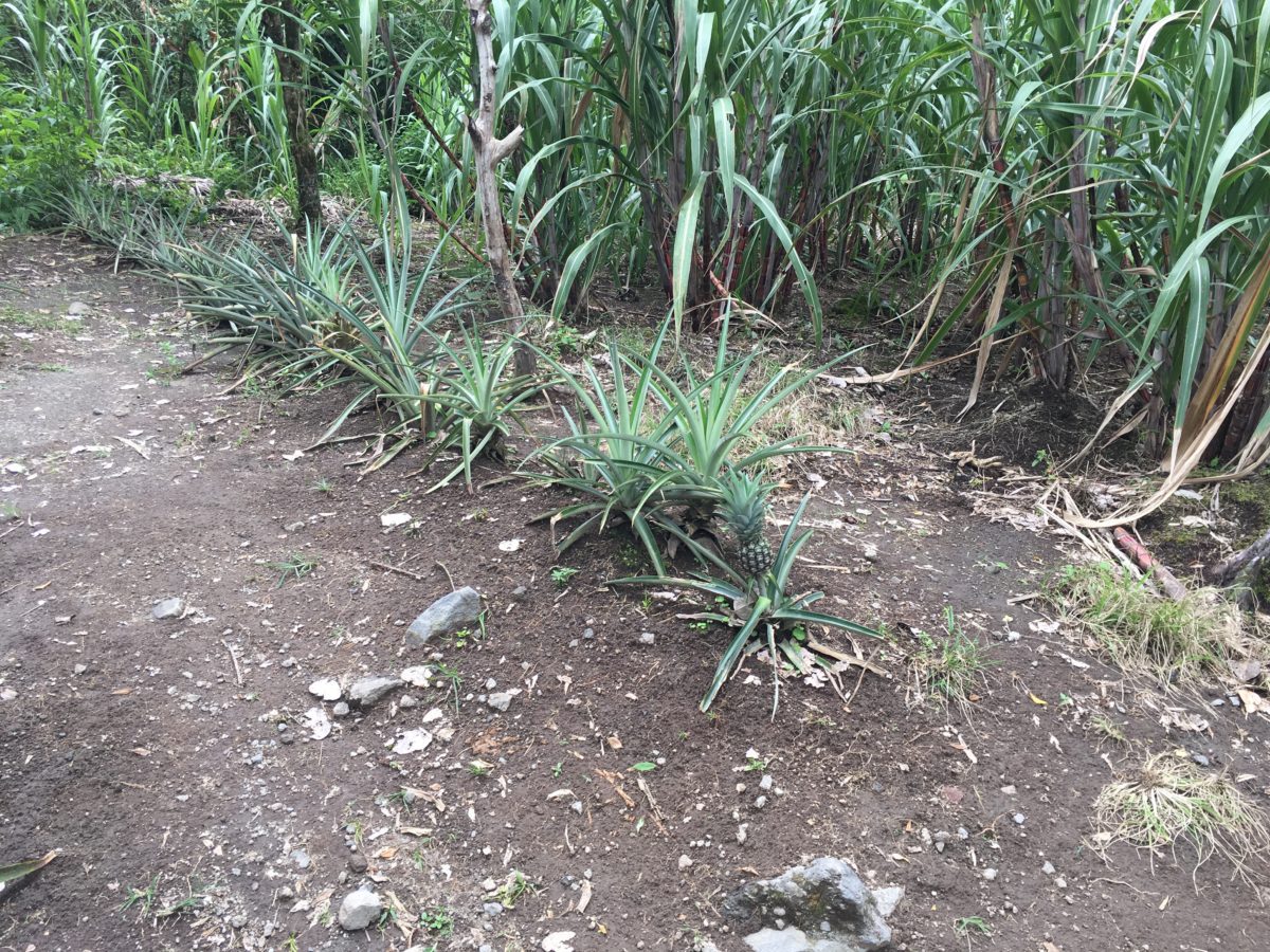
Pineapples and Sugarcane
They had some stalks of sugarcane growing, and I’ve always wanted to try it…so I grabbed a little stalk and cracked it open. It was delicious, but I really hoped I hadn’t offended the Arenal Volcano gods or anything (more on that in a minute).
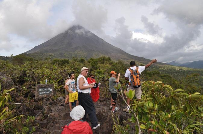
Next, there is a lookout of Arenal Volcano.
Keep following the little signs
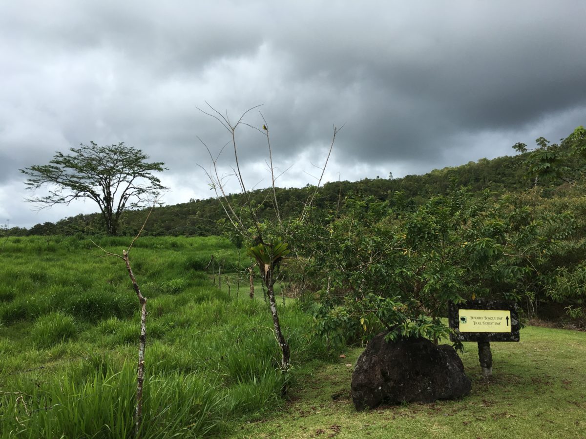
The trail travels along this fence on the edge of the jungle for about 10 minutes before taking you in
By the time we reached the entrance to the jungle, the weather turned downright hot. The sun was shining bright, and other hikers (and park workers) began removing layers of clothing to cope with the sweltering hot weather.
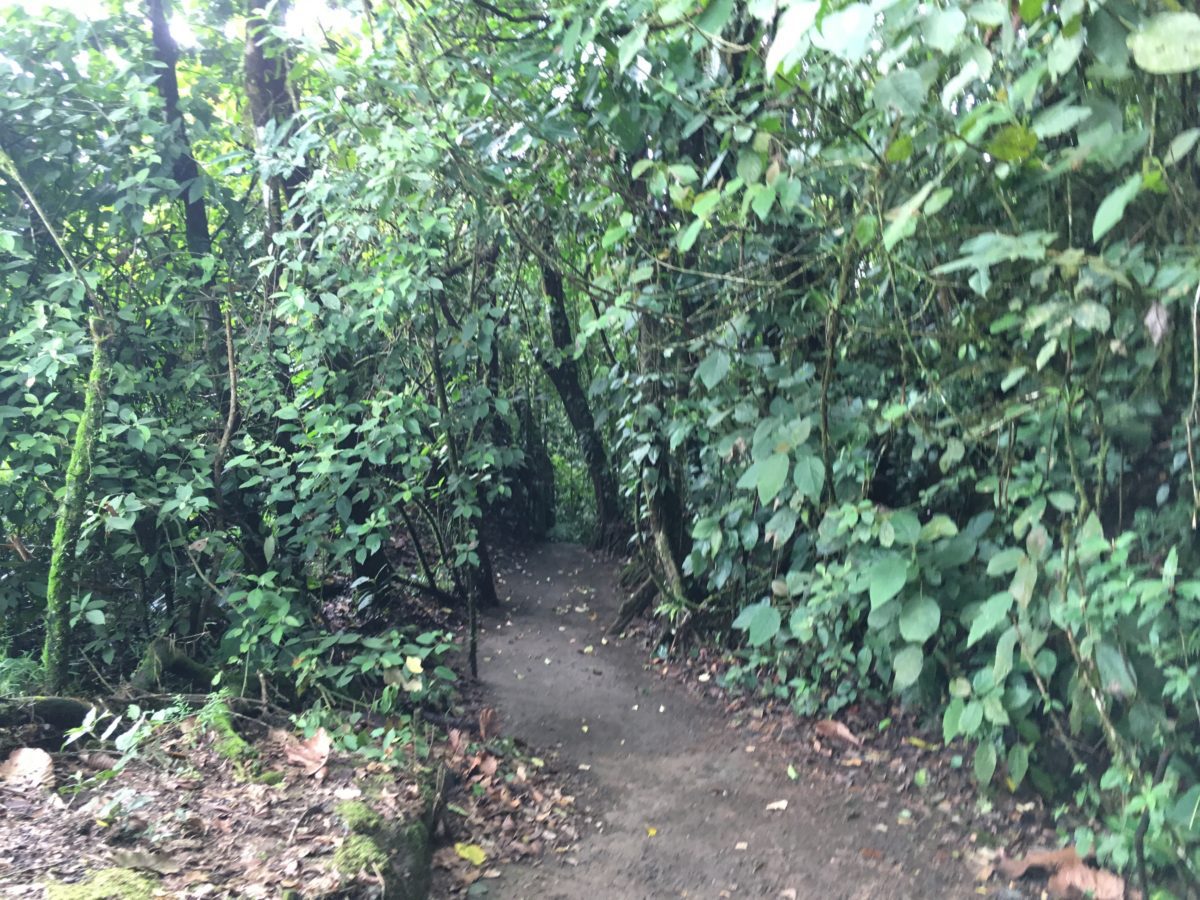
Welcome to the jungle
Soon, you’ll reach Lago Los Patos (“Duck Lake”).
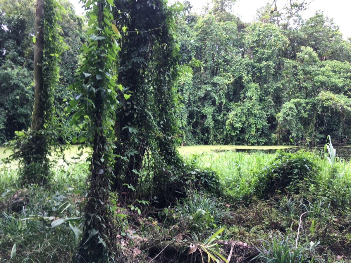
Lago Los Patos
The trail circles the lake before cutting back and heading back south into the lava flow section
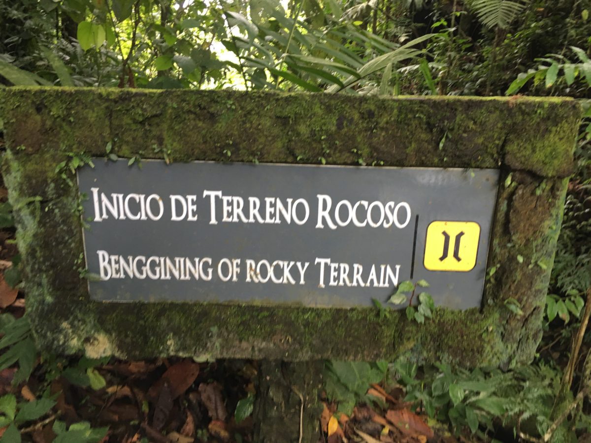
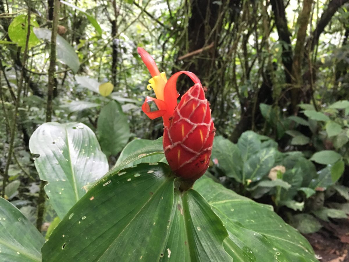
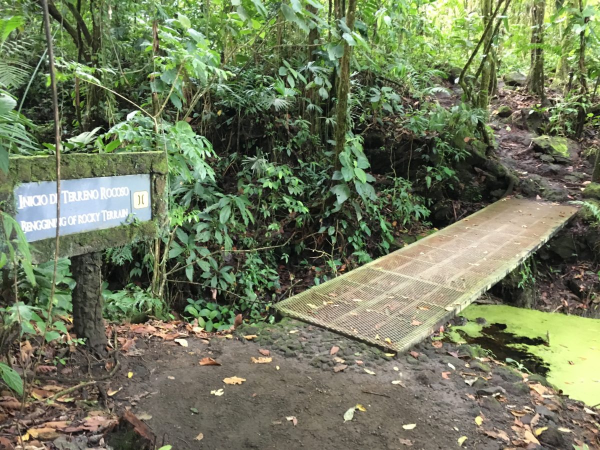
The next section was an uphill hike through the jungle over (non-slip) lava rock. It was an absolutely beautiful day with the sun blazing and the birds singing. We hit the first junction with the Colada trail and decided to keep going instead of turning back. Huge mistake.
(Image courtesy of www.wiztours.com)
The Gods of Arenal Were [Apparently] Not Pleased:
Remember earlier when I mentioned that thing about “not offending the Arenal gods”? Well, immediately after reaching the second junction of the Bosque trail and the Colada trail (aka the furthest possible point from the parking lot) the sun mysteriously and completely vanished. The skies darkened above. There was no warning.
The sky opened up and the Arenal gods unleashed the full force of their anger in the form of an aggressive torrential downpour complete with a furious display of lightning and thunder. There were no trees for cover. There was no where to hide. All we could do is run (Hence, original pictures in this blog post stop).
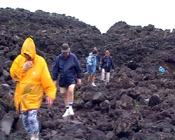
(Image courtesy of www.arenalvolcanoinn.com)
For the next hour, we proceeded to run down the Colada trail trying to make a B-line back to the parking lot. Along the way, we encountered numerous other hikers running for their lives as well. Thankfully, the porous lava rocks have a non-slip quality to them and the trail was easy to navigate.
Somewhere along the way, trail puddles turned into 2 inch rivers, and the 2 inch rivers turned into 8 inch deep lakes. Our “waterproof gear” was no match for the Arenal rainstorm. I was just hoping my phone and camera gear would survive.
Back at the Parking Lot:
Right on cue, literally the second we made it back to the parking lot (along with the many other hikers) the rain stopped completely. All of the hikers gave a look to each other and just started laughing uncontrollably. It was pretty hilarious. Never-the-less, we took the break in the weather to hustle back to the vehicles and grab a change in clothes (there are well-kept bathroom facilities in the parking lot with soap and sinks etc.). If anything, at least I’d be dry for the 3 hour drive back to the Andaz Peninsula Papagyo Resort.
Final Thoughts on Hiking the Arenal 1968 Trails:
As with most Costa Rican excursions, they are usually always better in the morning before the afternoon storms kick up. I can tell you first hand, the weather can change in an instant and the Arenal Volcano is capable of making its own weather.
The hike itself was one of the more fun hikes we did in Costa Rica. It was semi-long and had lots of interesting scenery with a large variety of differing landscape segments — all under the looming specter of the majestic Arenal Volcano. This is a popular activity for a reason!
Highly Recommended! (But bring waterproof bags for your valuables and phones – and don’t eat the sugarcane).
Cheers!